
Two Questions Turn Any Sky Into the Ten Types of Clouds
The ten types of clouds sort by two things: how high they sit and what shape they take. Learn Luke Howard’s Latin logic and read the sky on sight.
Every cloud you have ever squinted at belongs to one of ten families, and two questions sort it into the right one: how high is its base, and what shape is it. High, middle, or low. Layered, heaped, or wispy. Cross those two answers and a name falls out, which is how a forecaster can glance up for three seconds and say “altocumulus” the way you would read a word off a page.
That system is older than radar, older than the weather balloon, older than the first photograph of a cloud from above. A young London pharmacist named Luke Howard proposed it in 1802, in Latin, and it worked so well that the World Meteorological Organization still runs on his four root words. Learn the four roots and the three altitude decks and you have a grammar: cirro- tells you the height, -cumulus tells you the shape, and the two clip together into a name for a cloud you have never seen before. After that the sky mostly reads itself.
What is a cloud, exactly?
A cloud is liquid water droplets or ice crystals, each one condensed onto a speck of dust, salt, pollen, or smoke, suspended in air that is rising. Nothing more goes into the recipe, and the misconception worth clearing out first is that clouds are made of water vapour. Water vapour is a gas, and gases are invisible. The moment you can see it, it has already stopped being vapour.
Here is the sequence. Air rises. Rising air expands, because the pressure around it drops, and expanding air cools. Cool it enough and it can no longer hold all the water it was carrying, so the surplus condenses. It needs something to condense onto, though: a cloud condensation nucleus, typically under a micrometre across, of which the atmosphere holds an absurd number. Sea salt from breaking waves, mineral dust off deserts, sulfates, soot, spores. Laboratory air scrubbed of particles has to be pushed to several times saturation before a droplet will form on its own, while the real atmosphere, which is never that clean, manages on a fraction of a percent to spare.
The resulting droplets are small, roughly a hundredth of a millimetre across, and this is where people get suspicious. Water is about eight hundred times denser than air, so why doesn’t it fall? It does fall. A cloud droplet drifts down at about a centimetre a second, slow enough that the updraft feeding the cloud carries it back up faster than gravity takes it down. The usual classroom picture is an escalator running the wrong way under a crowd of very slow walkers, and like every analogy it has an edge: the escalator is not uniform. Where the rising air stops, the cloud stops, which is exactly why a fair-weather cumulus has that flat bottom, ruler-straight, as if someone trimmed it.
The mass involved is not trivial. A modest cumulus holds something like half a gram of liquid water per cubic metre, and a cloud a kilometre on a side is a billion cubic metres, so you are looking overhead at a few hundred tonnes of water going nowhere in particular. That is roughly the mass of a hundred elephants, held up by air moving a few metres a second.
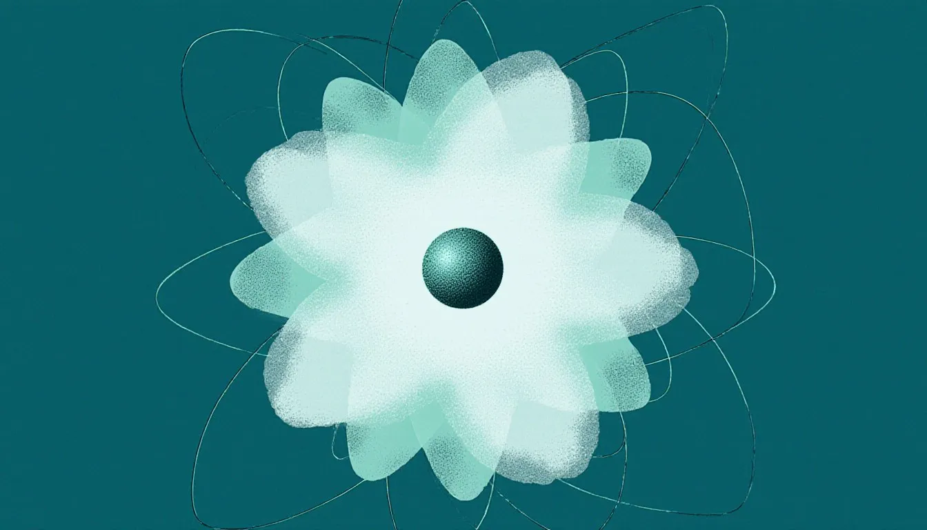
A cloud is better thought of as a process with a shape. The puff you are watching is being built at the top and dismantled at the edges, where dry air mixes in and evaporates the droplets away. An individual droplet may last only a few minutes inside a cumulus that keeps the same outline for an hour. (Chemistry borrows the word for the same reason, which is why electron cloud theory calls a smear of probability a cloud. Neither one is a thing you could hand someone.)
Who came up with the names we still use for clouds?
Luke Howard, a London pharmacist and amateur meteorologist, read a paper called “On the Modifications of Clouds” to a small scientific society in December 1802. He was in his early thirties and had no formal standing in the science. He proposed three fundamental forms with Latin names, plus a fourth for rain, and combinations built from them.
The four roots are worth memorizing because they do all the work:
- Cirrus: a curl or lock of hair. Fibrous, wispy, drawn out.
- Stratus: spread out, layered. A sheet rather than a lump.
- Cumulus: a heap or pile. Rounded, with a definite top and a definite bottom.
- Nimbus: rain cloud. It marks precipitation, and it clips onto a shape root rather than replacing one.
Combine them and you describe a cloud you have never seen before. Cirrostratus: a wispy, icy sheet. Stratocumulus: a layer that has broken into lumps. Cumulonimbus: a heaped cloud that has grown up and started raining on you. The rain label is the odd one in the set because it modifies rather than describes, and if that quirk of the naming logic interests you, nimbus clouds have their own longer story.
Howard was not the only person trying. Jean-Baptiste Lamarck published a French cloud classification at about the same time, using vernacular French descriptions, and it went nowhere. The usual explanation is the one I find convincing: Latin was neutral. A German, a Swede, and an Englishman could all adopt cirrus without any of them feeling they had adopted somebody else’s language. Howard’s names also came with a mechanism attached, since he understood the forms as stages a cloud could pass through rather than fixed species in a cabinet. That is why his four words survived a change of instruments, a change of century, and the arrival of satellite photography: each one still describes a thing air does.
The system spread fast and reached well beyond meteorology. Goethe admired the scheme enough to write verses in Howard’s honour, with sections named for the cloud forms, which is a career outcome few pharmacists achieve. Painters started studying clouds as objects with rules. By the late nineteenth century the international meteorological community had formalized Howard’s scheme into a published atlas, and the modern International Cloud Atlas, maintained by the World Meteorological Organization, is the direct descendant. The vocabulary has been extended, never replaced. Contrails, for instance, now have a formal name in the atlas as human-made cirrus, folded into the same Latin machinery Howard built.
Are clouds classified by height or by shape?
Both, and that is the part most cloud charts show without explaining. The classification is a grid. One axis is the height band, or étage, in which the cloud’s base sits. The other axis is the shape root. Ten combinations occur commonly enough in the real atmosphere to be recognized as genera, and those ten types of clouds are what any cloud classification chart on a schoolroom wall is showing you, arranged in exactly that grid.
The height bands, for the middle latitudes:
- High clouds, bases above roughly 6 km (about 20,000 ft): cirrus, cirrocumulus, cirrostratus. All ice.
- Middle clouds, bases between about 2 km and 6 or 7 km (roughly 6,500 to 23,000 ft): altocumulus, altostratus, nimbostratus. Mixed water and ice.
- Low clouds, bases below about 2 km (6,500 ft): stratus, stratocumulus, cumulus, cumulonimbus. Mostly liquid, except in the cold.
Two honest wrinkles in that tidy list. First, cumulus and cumulonimbus are filed as low clouds because a genus is assigned by the height of its base, and a thunderstorm’s base can sit a kilometre up while its top is at twelve. The base is what the classification measures, so a cloud twelve kilometres tall gets filed by its lowest thousand metres. Second, nimbostratus is listed by the WMO as a middle cloud, while several national weather services list it as low, because by the time it is raining on you its ragged base has usually sagged down near the ground. Both placements are defensible. When a professional body and your national forecaster disagree about a category boundary, the useful lesson is that somebody chose that boundary for convenience and it can be redrawn.
Those bands also shift with latitude. High cloud starts around 3 km over the poles and closer to 6 km over the tropics, because the whole troposphere is shallower in cold air and deeper in warm. So “cirrus lives above 6 km” is a mid-latitude convenience. Close only counts in horseshoes and estimation, and cloud heights are estimation.
Below genus, the atlas goes further: species describe internal structure and shape (cumulus humilis, the flat little fair-weather puff; cirrus uncinus, the hooked mare’s tail), varieties describe arrangement and transparency, and supplementary features cover attachments like the anvil, the trailing curtains of falling precipitation, and the pouches on a storm’s underside. Species and varieties are the tools for describing a cloud precisely: cumulus humilis says flat, small and fair-weather in two words, where “small cloud” says nothing anyone can check later. Learn a handful of them and your own notes on a sky are still readable a year on.
What do high-level clouds look like?
Thin, white, sharply lit, and made entirely of ice crystals, because at 6 to 12 km up the air sits near minus 40 °C, which is also minus 40 °F, the one temperature where the two scales agree, and liquid water has run out of options. High clouds cast almost no shadow on the ground. They cannot rain on you. What they can do is tell you what is coming, sometimes a day ahead.
Cirrus is the classic: detached white filaments, drawn out into strands and hooks. The strands are fallstreaks, ice crystals falling out of the cloud and being smeared sideways by wind shear, so a cirrus streak is a picture of how wind speed changes with height. The hooked kind, mare’s tails, curls because the falling crystals drop into slower air below. Sailors have long read a sky of mare’s tails and rippled cloud as a warning to shorten sail, and the old rhyme about a mackerel sky is still repeated at sea; the physics underneath is real enough, since both often ride ahead of an approaching warm front.
Cirrostratus is a transparent milky veil that can cover the entire sky without you noticing it arrive. Its signature is the halo: a ring of light at 22 degrees from the sun or moon, produced when light refracts through hexagonal ice prisms. Hold your arm out and spread your hand; the span from thumb to little finger is roughly 20 degrees, so the halo sits about a handspan from the sun. If you see that ring, a warm front is very likely on its way, and the folk saying about a ring around the moon meaning rain earns its keep more often than most weather lore does.
Cirrocumulus is the rarest of the three and the shortest-lived: a fine granulation of tiny white elements, ripples like sand on a tidal flat, with no shading anywhere in it. That last detail is the identification key. Cirrocumulus elements are so thin and so high that they cannot cast shadows on each other. The moment you see grey on the underside of the ripples, you are looking at altocumulus instead, one deck down.
What do middle-level clouds look like?
Grey enters the picture. Middle clouds are thick enough to shade themselves, and they hold a mix of supercooled water droplets and ice, which is why they look softer and heavier than anything above them. The prefix is a small historical joke: alto means high in Latin, and here it marks the middle deck, a leftover of nineteenth-century usage that nobody has bothered to fix.
Altocumulus is a layer broken into rounded masses or rolls, usually in regular patches with visible shading. The apparent size of the elements is the honest way to separate the three rippled genera. Look at a patch more than a third of the way up the sky and hold your hand out at arm’s length: cirrocumulus elements are narrower than your little finger, altocumulus elements are between a finger and about three fingers, stratocumulus elements are wider than that. It sounds crude. It is in the formal definitions, and it works from a driveway.
Altostratus is the featureless one: a uniform grey or bluish sheet, often covering the whole sky, through which the sun shows as a bright patch with no sharp outline. The standard description is the sun seen through ground glass, and once you have watched it you will not mistake it. No halo, because the crystals and droplets are too jumbled to refract cleanly. Altostratus can produce light precipitation, though it usually thickens into something worse first.
The two are often present at once, altocumulus rippling along the edge of an advancing altostratus sheet, and the changeover is worth watching because it usually means the layer is thickening. There is more on how altocumulus organizes into rolls and turrets, and more on why altostratus dims a sun it never quite hides.
Nimbostratus formally belongs in this band too, but it behaves like a low cloud and it is easier to meet it there.
What do low-level clouds look like?
Low clouds sit below about 2 km, close enough that you can often see them move against a chimney or a treetop. They are mostly liquid droplets, and they are the clouds that actually change your day.
Stratus is a featureless grey layer with a base low enough to hide the tops of tall buildings, and it produces drizzle, mist, or snow grains rather than proper rain. The useful thing to know is that stratus and fog are the same cloud. Fog is stratus that has settled onto the ground, or that formed there. Walk up a hill into a low overcast and you have physically entered a cloud, which is one of the cheapest experiments in atmospheric science and still worth doing on purpose.
Stratocumulus is stratus that has organized itself into lumps: a lumpy grey layer with darker rolls and often gaps of blue between them. It is the ordinary sky of a marine coastline and of a grey Tuesday, and by area covered it is widely reckoned the most common cloud on Earth, thanks to the vast sheets of it sitting over cool ocean water. It rarely does more than spit. If you can see individual rounded masses in a low layer and each one is wider than three fingers at arm’s length, that is your cloud.
Nimbostratus is the rain machine: a thick, dark, shapeless layer that blots out the sun completely and delivers steady precipitation for hours. No structure, no breaks, no drama, just a uniform grey ceiling with ragged shreds of cloud scudding beneath it. The distinction between nimbostratus rain and thunderstorm rain is one of the most useful in practical forecasting. Nimbostratus is patient and widespread, the product of a whole air mass being lifted gently over a front. A cumulonimbus is violent and local, and it is finished with you in twenty minutes. Nimbostratus rain can sit over the same county from breakfast to dusk.
The nimbus in that name is the same rain label Howard bolted onto his shape roots, and it appears in exactly two of the ten genera, always meaning the same thing: this one precipitates properly.
What are clouds with vertical development?
These are the ones built by rising thermals rather than by a whole layer of air being lifted, and they are the reason the height bands cannot tell the whole story. A convective cloud grows upward through the decks like a column, and the two genera in this group are the same cloud at different ages.
Cumulus starts when the ground heats unevenly, a bubble of warm air breaks away and rises, and it cools until condensation starts. The flat base marks the exact altitude where that happened, and every cumulus in the sky shares it, which is why they all appear to be sitting on a glass shelf. There is even a rule of thumb for that shelf: the base sits roughly 125 metres up for every degree Celsius of spread between the surface temperature and the dew point. Dry day, high bases. Muggy day, bases you could nearly touch. Fair-weather cumulus, the flat little humble ones that come out mid-morning and vanish at sunset, mean nothing worse than a sunny day with rising air over it. If that is what is overhead right now, there is more to know about cumulus clouds and how they organize themselves.
What turns a cumulus into a problem is latent heat. When water vapour condenses inside the cloud, it releases the energy that went into evaporating it, and that energy warms the air inside the cloud relative to the air outside. Warmer air is more buoyant, so it rises faster, so more vapour condenses, so more heat is released. The cloud starts feeding itself. This process drives more of severe weather than anything else, and it is why a cumulus can go from a harmless puff to a towering cauliflower in twenty minutes on a summer afternoon.
Cumulonimbus is the finished product: a tower that can span the entire troposphere, from a base under a kilometre to a top at 12 km in temperate air and higher still in the tropics. You know it has matured when the crisp cauliflower top goes fibrous and white, because the cloud has risen into air cold enough to freeze it. When it hits the tropopause it can rise no further, so it spreads sideways into the flat anvil, sometimes with the top overshooting slightly above the anvil like a blister, which is a sign of a genuinely powerful updraft. Updrafts in strong storms run to tens of metres per second, fast enough to keep hailstones aloft while they grow in layers.
One cumulonimbus is a thunderstorm, complete with lightning, hail, and downdrafts that hit the ground and spread out as gust fronts. Treat every one of them as electrically live: the National Weather Service rule is that if you can hear thunder you are close enough to be struck, so go indoors and stay in for thirty minutes after the last rumble. No tree, no dugout, no open field. The anatomy of one is easier to see than to read about, so before storm season starts, find pictures of what cumulonimbus clouds look like in profile, with the anvil, the overshooting top and the rain-free base marked, and get the shape into your head while the sky is quiet.
What about the odd-shaped clouds everyone photographs?
Mammatus, lenticulars and roll clouds all sit inside the ten already: one is a supplementary feature hanging off an anvil, one is a species, one is a variety of arrangement. Howard’s grammar had slots for them long before anyone had a phone camera to point at them. A short and deliberately incomplete tour of the ones people actually stop the car for:
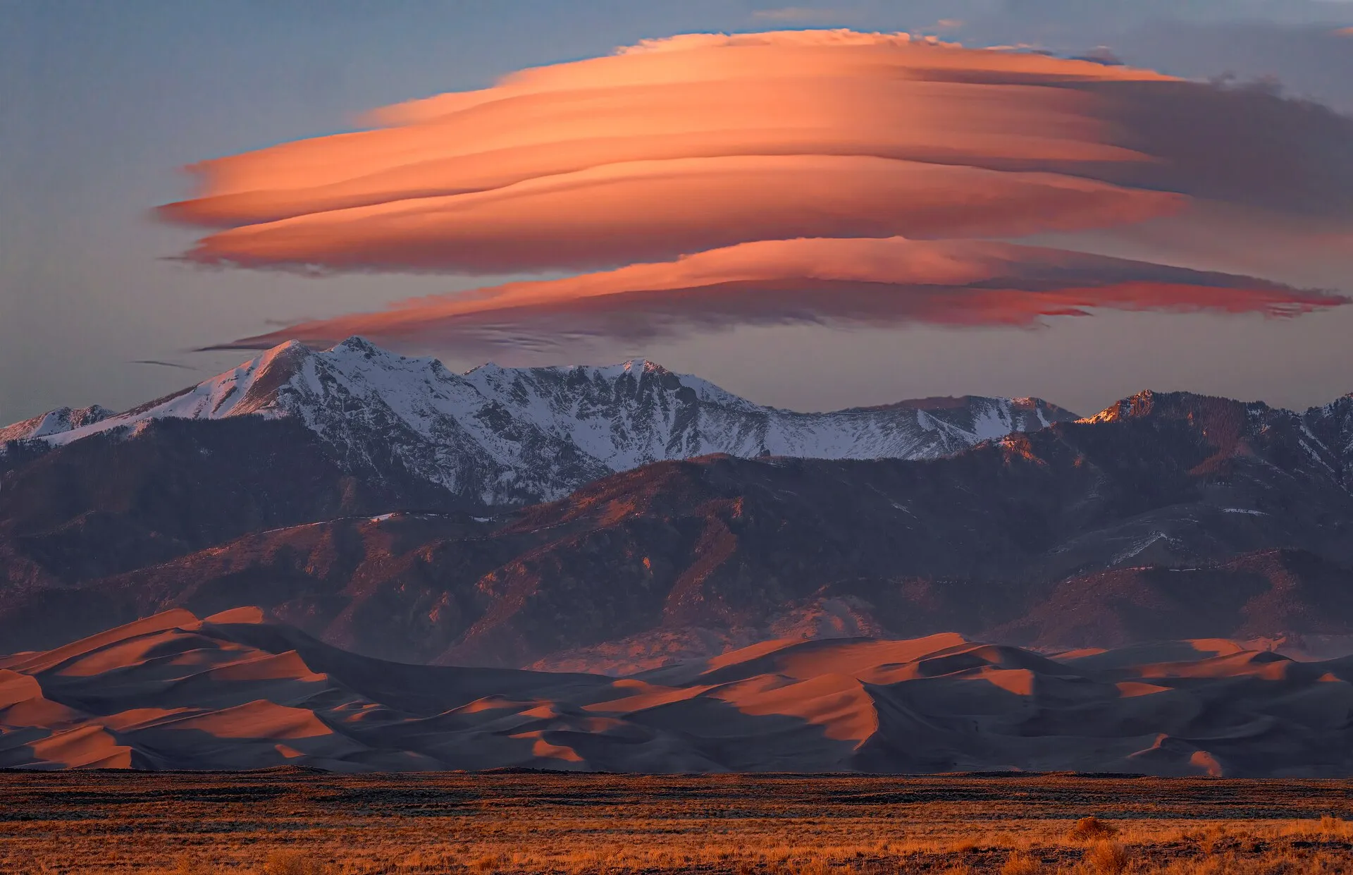
- Lenticular clouds, the smooth lens or stack-of-plates shapes that sit over and downwind of mountains. They form in standing waves in the airflow, which is the strange part: the cloud holds still while the wind pours through it, condensing on the way up the wave and evaporating on the way down. Pilots read them as a warning about turbulence. Live anywhere near a ridge and lenticular clouds will be the shape you see most often, usually on the windiest days.
- Mammatus, the pouches hanging from the underside of a storm’s anvil, usually lit gold by a low sun. They form in sinking, cooling air rather than rising air, which makes them one of the few cloud features built downward. They tend to appear on the back side of a storm, after the worst has moved on, so a sky full of mammatus clouds usually means the storm has already gone somewhere else.
- Roll clouds, long detached horizontal tubes that appear to rotate about their own axis, drifting free of any parent cloud. They now have a formal species name of their own in the atlas. Glider pilots fly hundreds of kilometres along the leading edge of the Morning Glory roll cloud in northern Australia, riding the air rising up its front face, and how that tube gets its spin while drifting free of any parent cloud is a puzzle worth chasing on its own.
- Shelf and wall clouds, both attached to a thunderstorm and routinely confused with each other, which matters because they mean opposite things about where the storm’s air is going. A shelf cloud rides the leading gust front; a wall cloud lowers beneath the rain-free base and can rotate. Telling a wall cloud from a shelf cloud is the one identification on this list with safety weight, and it is worth learning properly before storm season.
Which brings a rule I would rather state than imply: photograph storm structure from shelter. A rotating wall cloud, a lowering that persists, or a wind shift with a sudden temperature drop are all reasons to be inside a substantial building and checking official warnings, not standing in a field with a phone. The good storm photographs you admire were nearly all taken by people with an escape route and a radar feed.
How do meteorologists use cloud types to forecast weather?
Because each genus forms under particular conditions, a cloud is a readout of what the atmosphere is doing at that altitude right now. Modern forecasting runs on numerical models, satellites, and radar, but the underlying inference is unchanged and knowing the cloud types and what they mean hands you a rough version of the same readout from your own driveway.
The single most useful pattern is the warm front sequence, and it is the closest thing weather-watching has to a story with chapters. Warm air riding up over a wedge of colder air makes cloud from the top down, so you get the high stuff first and the base lowers steadily over a day or more:
- Cirrus appears, thin and hooked, hours to a day ahead.
- It thickens into cirrostratus. A halo shows up around the sun or moon.
- The veil lowers and greys into altostratus. The sun goes from sharp to a bright smear to gone.
- Altostratus thickens into nimbostratus and the steady rain starts.
Watch that run in order and you have watched a front arrive without a single instrument. It does not always complete: fronts weaken, dry air intrudes, the sequence stalls at stage two and clears. That is the honest version of the forecast, and it is why the sequence is a probability rather than a promise.
A cold front writes a different script. Cold air undercuts warm air and shoves it up abruptly, so instead of a gentle ramp you get a line of cumulonimbus, a sharp arrival, heavy rain and gusts for a short spell, then a rapid clearance into cool, bright air with fair-weather cumulus. Long lead-in and long grey rain means a warm front. Sudden wall of dark cloud and a fast clearance means a cold one.
Some genera are early warnings rather than weather in themselves. Altocumulus with small turret-like tops in the morning is a well-known sign of instability in the middle levels, and forecasters have long treated a turreted morning sky in summer as a hint that thunderstorms are likely by afternoon. Rapidly growing cumulus before noon says the same thing more bluntly.
And some clouds mean nothing at all, which is a point too many cloud guides skip. A sky of stratocumulus is a sky that is going to stay grey and do very little. Fair-weather cumulus that flatten out and dissolve near sunset, as the ground stops heating and the thermals shut off, are telling you only that today was sunny. Knowing which clouds carry no information is as much a part of reading a sky as knowing which ones do.
How can you start identifying clouds from your own backyard?
Go outside in daylight and ask the two questions in order. How high, and what shape. Height first, because it narrows ten options to three or four: white and thin with no shading is high, grey with soft shading and no crisp edges is middle, dark and detailed with visible motion is low. Then shape: a flat sheet is stratus, a heap with a defined top is cumulus, fibrous strands are cirrus, and if it is raining on you steadily, add nimbus. Almost every sky you meet resolves in under a minute, and the three-band list further up this page has all ten names arranged the same way any weather classroom’s chart arranges them.
A few habits speed it up. Use your hand as a protractor for element size, since the finger-and-handspan trick separates cirrocumulus from altocumulus from stratocumulus faster than any description will. Look at the same patch of sky twice, ten minutes apart, because growth tells you more than shape does: a cumulus that is visibly taller than it was is a cumulus with plans. Photograph the ones that puzzle you and look them up in the evening; the ambiguous cases are where the learning is, and most real skies are ambiguous, carrying two or three genera at different levels at once.
Then watch for the sequence. Catch a halo one afternoon, note the time, and see whether rain arrives inside the next day. You will be right often enough to feel slightly smug and wrong often enough to stay honest, which is a fair description of forecasting generally. The sky has been running this demonstration continuously for four billion years, and the only entry fee is looking up on purpose.
Nora Whitfield
Staff Writer
Nora Whitfield taught high-school chemistry and physics for twenty-eight years, and she has never once answered "when will I use this?" with a sigh. She believes any honest question about how the world works deserves an answer that is both correct and actually understandable.