
Every Landform Is a Score in a Fight Between Building and Wearing Down
The major types of landforms on Earth, organized by the force that built them: tectonic, river, coastal, wind, and ice, with examples of each.
Stand on a river bank a week after a flood and you can watch a landform being born. The water has dropped, and where the channel widened there is now a fan of fresh silt, maybe ankle-deep, with the last of the current still combing it into ridges. Give that fan a thousand floods and it becomes a floodplain. Give it a river mouth and ten thousand years and it becomes a delta the size of Bangladesh. That is the honest answer to what the types of landforms are: every one of them, from the Andes to the sandbar behind your knees, is a running score in a contest between forces that pile material up and forces that carry it away. Sort them by that contest and the whole family finally makes sense.
Most lists sort them by shape instead. Mountain, valley, plateau, hill, plain, and on down the alphabet, which tells you what a thing looks like and nothing about why it looks that way. Below, the same landforms arranged by the process that made them: tectonic, river, coastal, wind, and ice, with the erosion-and-deposition pair running underneath all of it. Learn the process and you can identify a landform you have never seen before, which is the whole point.
What actually counts as a landform?
A landform is a natural feature of the Earth’s solid surface with a recognizable shape and a describable origin. That covers a mountain range and it covers a sand dune two metres high, which surprises people. A dune and the Himalaya sit in the same family because each has an origin you can describe: wind piling sand against an obstacle, two continents colliding. Origin is what earns a feature the name, at any size.
Here is the misconception worth killing first, because it quietly wrecks everything that follows: landforms are not permanent, and they are not finished. School diagrams show them as fixed nouns, drawn in cross-section with a neat label and an arrow, and the arrow does the damage. It suggests the thing has arrived. Nothing has arrived. The Appalachians were once a young range comparable to the Alps, and they have been coming apart for hundreds of millions of years, grain by grain, into rivers that carry the pieces to the Atlantic. Niagara Falls has retreated upstream by roughly eleven kilometres since the last ice sheet left, and it is still going. The cliff you photographed on holiday is shorter than it was when your grandparents saw it.
So every landform name is the name of a stage. When geologists describe a feature they are saying what this material looks like at this point in a process that started before people and will not stop for them. A V-shaped valley is a young river’s work. A U-shaped valley is what happens when a glacier gets hold of that same valley and squares it off. A meandering river on a wide flat plain is an old river with nothing left to cut down into. The water is doing the same work in all three; what changes is how much time it has had, and whether ice took a turn at the valley first.
Each landform is described by a handful of measurable properties: slope, elevation relative to sea level, the rock and soil it is made of, how those materials are layered, and which way the whole thing is oriented. Those five are what let a geologist working from a topographic map or satellite data classify ground they have never walked on, and they are the backbone of systems like the landform classification the USGS uses for mapping American terrain. Read those five properties together and they point back at a process: shale under a hard cap, layers still horizontal, a steep edge on every side, and you are looking at what water and frost left behind when they stripped the surrounding rock away.
How do geologists sort landforms into types?
The cleanest classification of landforms starts with two opposing families of process. Constructive forces build land up: they add material, raise elevation, and create new surface. Destructive forces wear land down: they break rock apart, move the pieces, and lower elevation. Every landform on the planet is the current result of those two working on the same ground at once.
Constructive processes are mostly powered from inside the Earth. Plate tectonics drives continents into each other and throws up mountain ranges. Magma rises and builds volcanoes, lava plains, and whole islands. Crust warps upward and lifts a plateau. Deposition, which is powered from outside by water, wind, and ice, is also constructive, and it is the one people forget: a delta is built land, just as surely as a volcano is.
Destructive processes are powered from outside. Weathering breaks rock in place, chemically and physically. Erosion picks the broken pieces up and carries them off. Mass wasting is gravity taking the whole slope down at once, from a slow soil creep that tilts fenceposts to a rockfall that closes a highway. The full catalogue of each side is split across two pieces, examples of constructive forces of nature and examples of destructive forces of nature, working through the mechanisms one at a time.
The thing to hold onto is that they are never separate. A mountain is being built and destroyed simultaneously, and the shape you see is the balance. In the Himalaya, uplift is fast enough that the range is still gaining height despite rivers cutting gorges into it as quickly as they can manage. In the Appalachians, uplift stopped long ago and erosion has had an uninterrupted run, which is why the ridges are rounded and low. Uplift and erosion run in both ranges; only the balance between them has changed.
Within that frame, the standard families sort themselves by which agent is doing the work:
- Tectonic and volcanic: built by crustal movement and magma. Mountains, plateaus, rift valleys, volcanic islands, calderas.
- Fluvial: shaped by running water. Valleys, canyons, floodplains, meanders, deltas, alluvial fans, waterfalls.
- Coastal: shaped by waves and tides. Sea cliffs, arches, stacks, spits, beaches, peninsulas.
- Glacial: shaped by moving ice. Cirques, arêtes, fjords, moraines, drumlins, eskers, U-shaped valleys.
- Aeolian: shaped by wind. Dunes, loess deposits, yardangs, mushroom rocks, and the wind-assisted retreat of mesas and buttes.
- Karst and solutional: shaped by chemical dissolution. Caves, sinkholes, limestone pavements.
A fair warning about the boxes: plenty of landforms belong in two of them. The Grand Canyon is fluvial in that the Colorado River cut it, but it exists at that depth because the Colorado Plateau was lifted a couple of kilometres first, which is tectonic. Fjords are glacial troughs that the sea has since flooded, which makes them coastal too. Categories are filing cabinets for human convenience. The rock has never read the labels.
Which landforms come from forces that build the land up?
The biggest landforms on Earth are tectonic, because only the planet’s interior has enough power to make something the size of a mountain range. The lithosphere is broken into plates that move at roughly the rate your fingernails grow, a few centimetres a year, and where two of them meet, something has to give.
Fold mountains form where plates converge and sedimentary layers that were once flat get squeezed, buckled, and stacked. The Himalaya are the extreme case, still rising because India is still driving north into Asia. The Alps and the Appalachians are the same process at different ages.
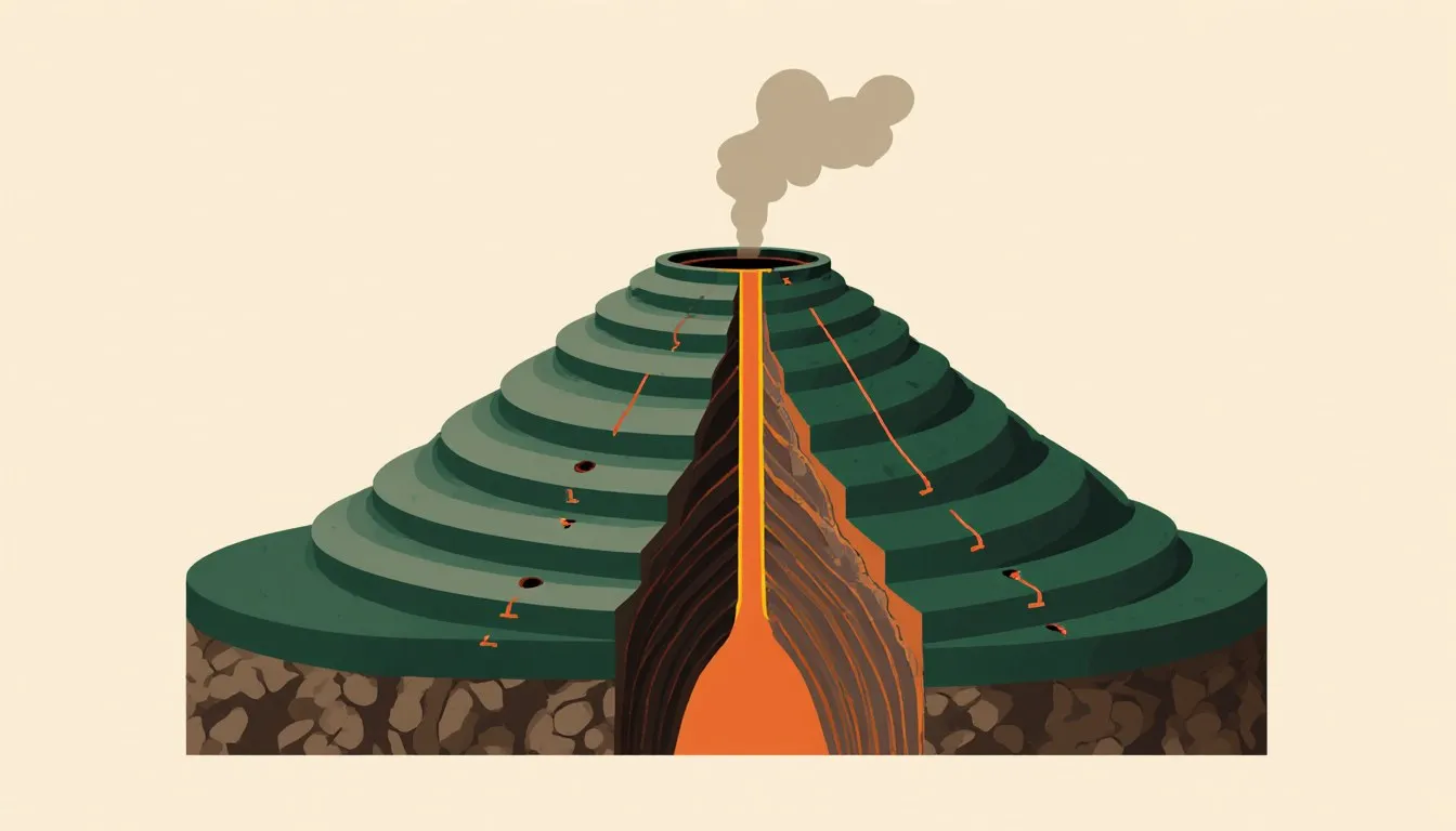
Volcanic mountains build from the top down, one eruption at a time, out of lava and ash rather than folded strata. A steep-sided stratovolcano and a broad shield volcano like Mauna Loa are made of different lava with different viscosity, which is most of why they have different silhouettes. Runny basaltic lava spreads out and makes a shield. Sticky, gas-rich lava piles up near the vent and makes a cone.
The Andes are the textbook case of both at once, since subduction of oceanic crust beneath South America both crumples the continental margin and feeds a chain of volcanoes along it. The full sequence is worth reading properly, and the formation of the Andes mountain range takes it apart in order, from the descending slab of ocean floor to the volcanoes standing on top of the wreckage.
Block mountains and rift valleys come from the opposite motion. Where the crust is pulled apart, blocks drop along faults and neighbouring blocks stand proud. The East African Rift is a continent in the process of splitting, with the valley floor sinking between escarpments.
Plateaus are large elevated areas with a relatively flat top and at least one steep edge. Some are lifted bodily by tectonics, like the Tibetan Plateau, whose average elevation is over 4,000 metres (about 13,000 feet) and which owes its height to the same collision that built the Himalaya. Others are built by repeated floods of fluid lava that spread across the landscape and stack up: the Deccan Traps in India and the Columbia River Basalt Group in the American Northwest are both this kind. Volcanic plateaus tend to weather into rich soils, which is why an awful lot of agriculture happens on old lava.
Volcanic islands are mountains that started underwater and kept going. Some sit above hotspots, stationary plumes of rising magma that the plate slides over, which is how the Hawaiian chain got built in a line with the youngest island at the live end. Others rise along island arcs above subduction zones, like the Marianas. Iceland is doing something else again, sitting on a spreading ridge that has built enough crust to break the surface.
Calderas and crater lakes are what a volcano leaves when it empties its magma chamber and the roof collapses. Fill that bowl with rain and snowmelt over centuries and you get Crater Lake in Oregon, which is the deepest lake in the United States and holds no inflowing or outflowing river, only what falls from the sky.
Also constructive, and often left off these lists: plains. Much of the world’s flat lowland is built ground, assembled from sediment that rivers, glaciers, and wind stripped off higher country and dropped where the energy ran out. The Great Plains, the Indo-Gangetic Plain, the Pampas: these are the bill for somebody else’s erosion. Even the deep ocean floor has abyssal plains, among the flattest surfaces on the planet, built from a slow rain of fine sediment and the remains of marine organisms.
Which landforms come from forces that wear the land down?
Destructive processes get less credit than they deserve, because the results do not look like achievements. Nobody photographs a hillslope that has quietly lost two metres. But the tearing-down side of the ledger is what carves everything sculptural on Earth, and it works in three distinct stages that are worth keeping separate in your head.
Weathering breaks rock without moving it. Physical weathering does it mechanically: water gets into a crack, freezes, expands, and levers the crack wider, and after enough winters the block comes off. Roots do a slower version of the same job. Desert rock flakes as it heats and cools through huge daily swings. Chemical weathering does it by reaction: rainwater with dissolved carbon dioxide is mildly acidic and eats carbonate rock, oxygen rusts iron-bearing minerals, and feldspar hydrolyses into clay. Chemical weathering is why the same limestone that stands up as a cliff in a dry country dissolves into caves in a wet one.
Erosion is the removal step. Water, wind, ice, and waves pick up the loosened material and carry it. This is the part with the mileage: rivers alone move billions of tonnes of sediment to the sea every year.
Mass wasting is gravity acting directly on a slope, with or without a transport agent. It runs from soil creep, so slow you only notice it because the old wall at the bottom of the field is bulging, to debris flows and rockslides that rearrange a valley in under a minute. Every slope on Earth is sitting at some angle, and the material on it has a maximum angle it can hold before it moves. Undercut the base, saturate it with rain, or shake it with an earthquake, and it goes.
The purely erosional landforms are the ones where removal has done all the shaping. Canyons are deep, narrow, steep-walled valleys cut by rivers in dry country, where there is not enough rain to widen the walls as fast as the river deepens the floor. The Grand Canyon exposes rock layers spanning a huge slice of geological time in its walls, which makes it a stratigraphic column you can hike down.
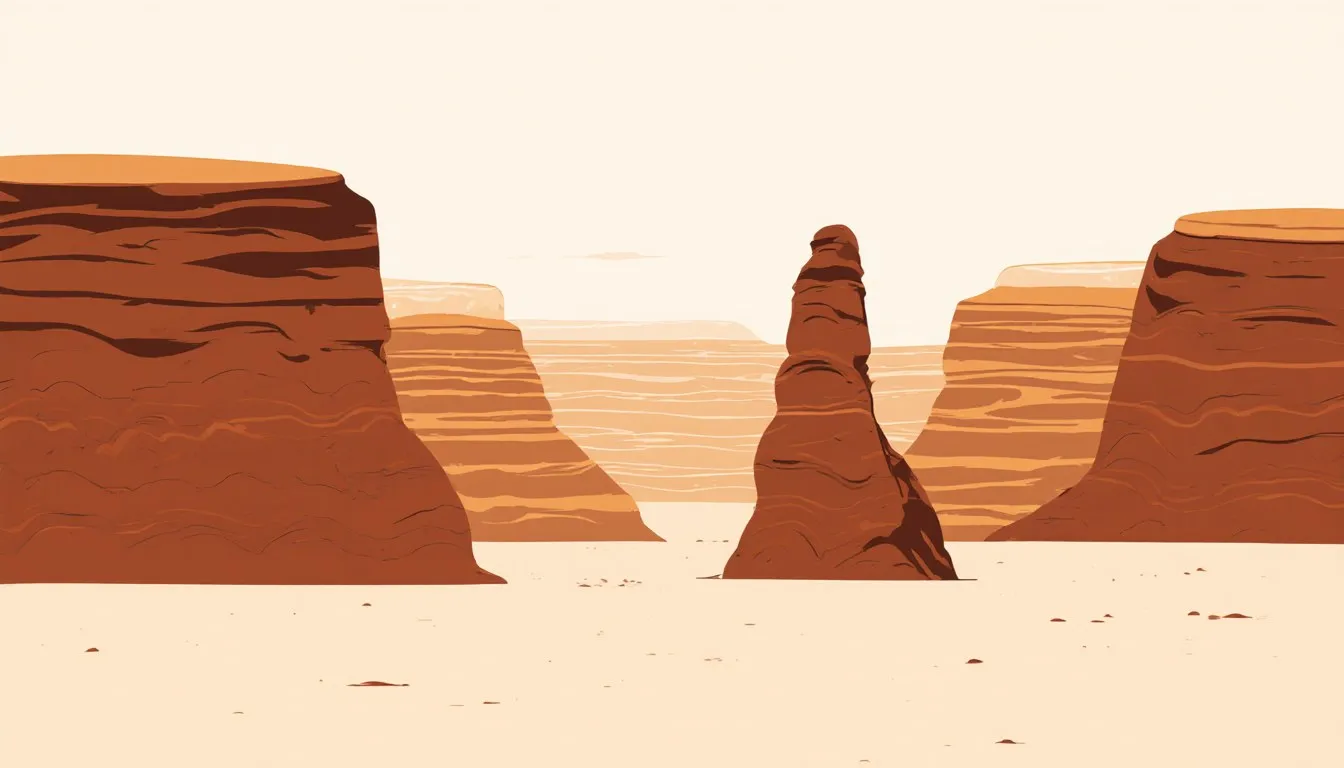
Mesas and buttes are erosional leftovers rather than things that were built. Start with a flat-lying sequence of sedimentary rock capped by a hard, resistant layer. Erosion strips away the unprotected surroundings, and wherever the caprock survives, it shields the softer rock beneath it like an umbrella. What remains is a flat-topped, steep-sided remnant. A mesa is broad, wider than it is tall, from the Spanish for table. A butte is what a mesa becomes after the sides retreat far enough, a narrow tower with the same flat lid. Monument Valley is a landscape of exactly this sequence caught at different stages, which is why it reads so strangely: the empty air between the towers is the volume that used to be rock, and the towers themselves mark the few places where the caprock held.
Karst deserves its own mention because it is destruction by chemistry rather than force. Slightly acidic groundwater dissolves limestone along joints and bedding planes, widening them into conduits and then into caves. When a cave roof fails, the surface drops into a sinkhole. Whole regions of southern China, Slovenia, and Kentucky are drained almost entirely underground. For a tour of these processes at work in specific places, examples of erosion around the world collects them.
What landforms do rivers carve and build?
Rivers are the most productive landform-makers on the continents, and the reason is simple arithmetic: water is heavy, it flows downhill everywhere it can, and it never stops. Follow a single river from its head to the sea and you get most of the fluvial family in order.
In the upper course, the gradient is steep and the water has energy to spare, so it spends it cutting downward. That produces the classic V-shaped valley, narrow at the bottom where the river is working and widening upward as the sides weather back and slump in. Interlocking spurs stick out from alternating sides where the river has swung around obstacles it could not cut through. Where the channel crosses a band of hard rock sitting above softer rock, the soft rock erodes faster, undercuts the hard layer, and a waterfall develops. It does not stay put: the plunge pool keeps excavating backwards under the lip until the overhang collapses, and the fall retreats upstream, leaving a gorge behind it. The mechanics get a full treatment in how are waterfalls formed, and the broader question of where a river comes from in the first place is covered in how are rivers formed.
In the middle course, the gradient eases and the river starts spending its energy sideways instead of down. It meanders, and meanders are one of the tidiest demonstrations in physical geography of erosion and deposition working as a pair. On the outside of a bend the water moves fastest, so it cuts, forming a steep river cliff. On the inside it moves slowest, so it drops its load, forming a gentle point bar. Erosion on one bank, deposition on the other, and the whole bend migrates sideways across the valley floor. Push it far enough and the neck of the loop gets so thin that a flood cuts straight through, abandoning the bend as an oxbow lake. That lake will silt up and become a marsh and then a scar on the floodplain, which is why old river valleys seen from an aeroplane look like a page of doodles.
The floodplain itself is built land, laid down by the river overtopping its banks and dropping sediment across the flat. Coarse material settles first, right at the channel edge, which builds natural levees, raised banks of the river’s own making. Where a fast mountain stream bursts out onto a plain and abruptly loses the speed to carry anything, it dumps its whole load in a spreading alluvial fan.
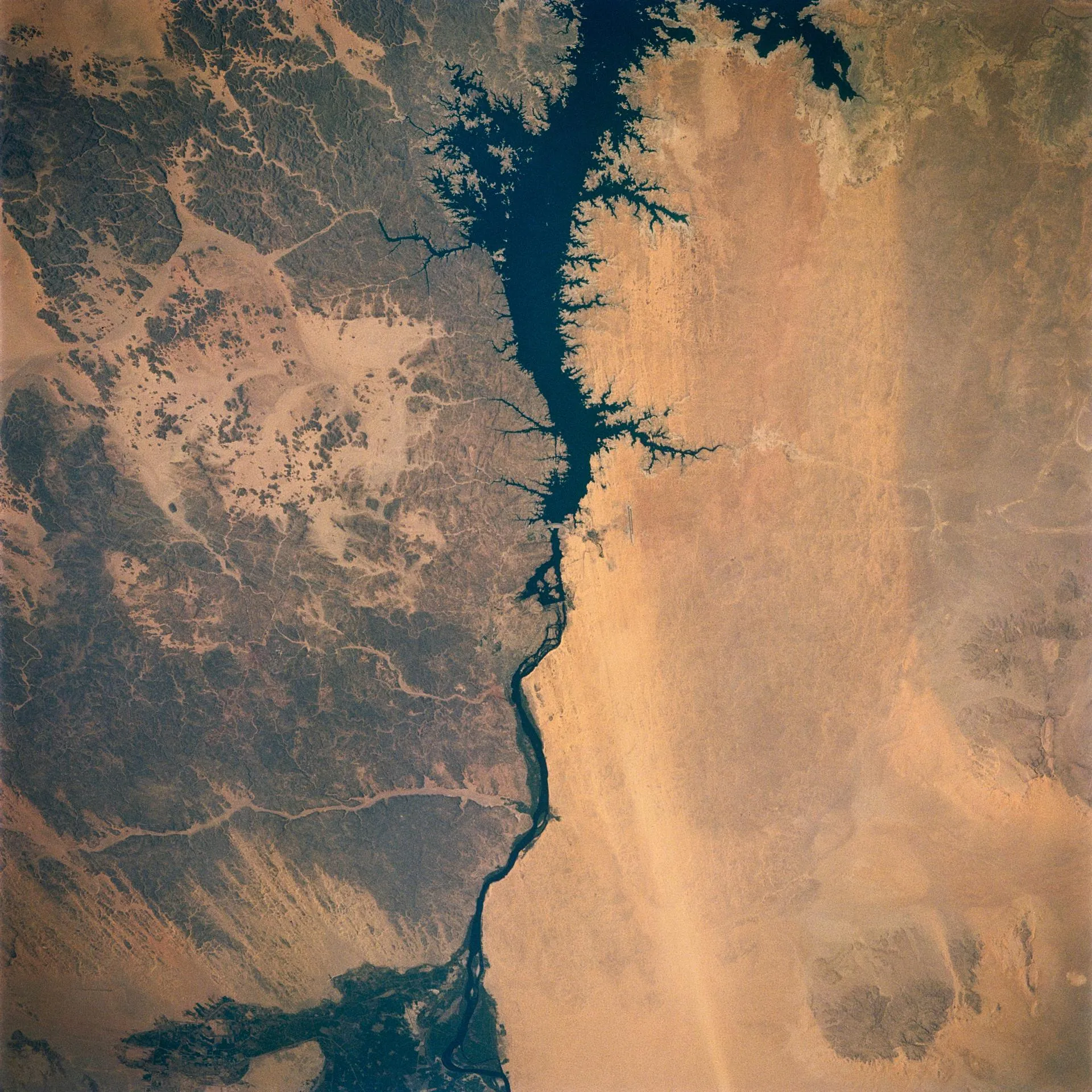
In the lower course, the river is wide, slow, and heavily loaded, and when it meets standing water it stops dead. Everything it was carrying comes out of suspension, and a delta grows. The Ganges-Brahmaputra Delta is the largest on Earth and the sediment feeding it was, not long ago in geological terms, Himalayan mountain. One sentence holds the whole system: rock lifted by a plate collision, broken by frost and rain, carried a couple of thousand kilometres by water, and set down as farmland for tens of millions of people. Constructive and destructive, hand in hand.
It is worth seeing what this machinery does when a continent gives it room to work. The longest river in the world and the widest river in the world sit at the two extremes of that, and both will quietly reset whatever you currently picture when someone says the word river.
What landforms does moving water leave behind?
Deposition is the quiet half of the story. Every grain that erosion removes ends up somewhere, and where it stops is decided by one variable above all others: energy. Moving water can carry a particle only as long as it keeps moving fast enough. Slow it down and the heaviest material drops first, then the next heaviest, and so on down to the clay that will stay in suspension until the water is nearly still.
That single rule explains the sorting you see in depositional landforms, and it is the thing most classroom treatments skip. Sediment does not just accumulate, it accumulates in order. Gravel at the top of an alluvial fan, sand in the middle, silt at the toe. Coarse levee deposits by the channel, fine mud out on the floodplain. Sand near a delta’s head, clay carried out to the delta front and beyond. If you find yourself in a road cut looking at layered sediment, the grain size is telling you how fast the water was going when it gave up.
The everyday version is a sandbar. Watch any stream where the channel widens or bends and you will find a bank of sand exactly where the current loses its grip, usually on the inside of the curve or in the lee of an obstruction. It will move next spring. A river bar is a delta in miniature and it works by identical physics, which is a genuinely useful thing to notice, because the same processes at delta scale are hard to see and easy to misjudge.
The larger depositional forms are worth naming as a set:
- Deltas: built at river mouths, classed by whether the river, the waves, or the tides dominate the shaping. The Mississippi is river-dominated and pushes lobes out into the Gulf. Wave-dominated deltas get smoothed into a neat arc.
- Alluvial fans: cone-shaped deposits where a confined stream hits open ground and spreads.
- Floodplains and levees: the flat, fertile ground that rivers build for themselves during overbank floods.
- Point bars and spits: deposits on the slow side of a bend, and on a coast where longshore drift carries sand past a headland and drops it into open water.
- Loess: wind-deposited silt, often glacially ground, that can build blankets metres thick. It weathers into some of the most productive farmland anywhere, including large parts of the American Midwest and northern China.
Deposition also has a habit of preserving the record. A delta or a lake bed accumulates layer on layer, oldest at the bottom, and those layers are where the fossils are and where the rock of the next continent starts. Erosion writes the landscape; deposition keeps the receipts. If you want that whole side of the ledger in detail, understanding deposition in geology with examples is where it gets the full treatment.
What landforms does the coast shape?
The coast is where the two forces are most obviously in a hurry. Waves arrive relentlessly, several thousand times a day, and each one is delivering the energy of a storm that may have happened a thousand kilometres away. Nowhere else can you watch a landform change on a human timescale so easily.
Wave erosion works by several mechanisms at once. Hydraulic action is water and compressed air forced into cracks under pressure, prising the rock apart. Abrasion is the waves throwing sand and pebbles at the cliff face, which is sandpaper on a geological scale. Solution dissolves soluble rock, and attrition is the fragments knocking each other round until beach shingle is smooth.
Point those at a cliff and a sequence unfolds that is close to a laboratory demonstration. Waves attack hardest between the low and high tide marks, cutting a wave-cut notch into the base. The notch deepens, the overhanging rock loses its support, and it falls. The cliff has now retreated a metre or two and the process starts again, leaving a wave-cut platform, a flat rocky shelf exposed at low tide that records exactly where the cliff used to stand.
On a headland, weaknesses get exploited first. A joint or fault in the rock erodes into a cave. If the sea works through from both sides of a narrow headland, the caves meet and you have an arch. Arches are structurally doomed: the sea keeps widening the base while weather works on the top, and eventually the roof collapses, leaving an isolated pillar of rock offshore. That is a sea stack, and it will itself be undercut until it topples into a stump visible only at low tide. Headland, cave, arch, stack, stump, in that order, every time, and what is a sea stack and how is it formed follows one through its whole life.
The constructive side of the coast is just as busy. Waves rarely hit a beach square on, so they push sediment up the beach at an angle and gravity pulls it straight back down, which walks material along the shore in a zigzag called longshore drift. Where the coastline turns and the drift keeps going, sand builds out into open water as a spit, often with a hooked end where waves refract around the tip. If a spit grows right across a bay it becomes a bar, sealing off a lagoon behind it. Tie an island to the mainland the same way and it is a tombolo. Beaches themselves are deposits, and they are seasonal: many are broad and sandy after a calm summer and stripped to cobbles after a winter of storms. Same beach, different weather.
Peninsulas sit slightly apart from all this, since a large one usually owes its outline to tectonics or to sea level rather than to wave work alone. The name comes from the Latin for “almost island”, which is a rare case of a technical term being exactly as helpful as it sounds.
What landforms does wind sculpt in deserts?
Wind is a weak agent compared with water, and there is a reason it only gets to run the show in deserts: it can only move loose, dry, fine material, and almost everywhere else on Earth, vegetation and moisture hold the surface down. Take away the plants and the damp, and wind becomes a landscape architect.
Aeolian erosion works two ways. Deflation is the wind lifting fine particles and removing them, sometimes lowering a whole surface and leaving behind a lag of stones too heavy to move, a desert pavement. Abrasion is sand-blasting, and because sand grains are heavy they mostly travel close to the ground, bouncing rather than flying. That detail explains a landform students always ask about: the mushroom rock, undercut near its base and broad on top, is carved by a wind that only carries its cutting tools in the bottom metre or so of air. The narrow waist marks the height the sand could reach; above that line the wind blows clean and the rock keeps its full width.
Yardangs are ridges streamlined by wind blowing consistently from one direction, aligned like a fleet at anchor. And dunes are the wind’s signature landform, built when sand-carrying wind meets an obstacle or a lull and drops its load. A dune has a gentle windward slope where grains bounce up and a steep slip face on the lee side where they avalanche down, and because grains are constantly being moved from one face to the other, the whole dune migrates downwind. Whole dunes travel metres in a year while keeping their shape, which makes them one of the few landforms you can genuinely watch move.
Dune shape depends on how much sand there is and how steady the wind is:
- Barchan: crescent-shaped with horns pointing downwind, forming where sand is limited and the wind is one-directional. One of the most common types.
- Transverse: long ridges at right angles to a steady wind, where sand is plentiful.
- Linear (seif): long parallel ridges running roughly with the wind, in bidirectional wind regimes.
- Star: multiple arms radiating from a central peak, formed where wind comes from several directions across the year. These grow upward rather than travelling, and some are enormous.
- Parabolic: crescent-shaped like a barchan but with the horns pointing upwind, anchored by vegetation. Common in coastal dune fields.
Mesas and buttes sit in the desert too, and they belong to both the erosional and the aeolian families, since wind removes the debris that water and frost break loose so the retreat can continue. This is where categories overlap most awkwardly, and where I would tell a class to stop worrying about the label and describe what is happening instead. A butte in Monument Valley is being taken apart by frost, by the rare cloudburst, and by wind, and nothing is gained by declaring one of the three the winner.
Deserts are not defined by heat or by sand, incidentally, but by how little precipitation they receive, which is why Antarctica qualifies as one and why sand seas cover only part of the Sahara. For where these landscapes actually are, open deserts of the world and the list of deserts around the world, and watch how many of the big ones sit at roughly matching latitudes north and south of the equator. That pattern is atmospheric circulation leaving its fingerprints on a map.
What landforms does ice leave behind?
Glacial landforms are the ones that most often turn up somewhere the ice has not been for ten thousand years, which is why so much of northern Europe and North America is decorated with features nobody living has seen being made. A glacier is a mass of ice thick enough that its own weight makes it flow, and there are two useful kinds: alpine glaciers, which sit in mountain valleys, and ice sheets, which bury entire landscapes and are currently found only in Greenland and Antarctica.
Ice erodes by two mechanisms. Plucking is meltwater freezing into cracks in the bedrock and then ripping blocks out as the ice moves on. Abrasion is those embedded blocks being dragged along the floor, scratching and polishing it, which is why glaciated bedrock carries parallel striations pointing the way the ice went. Those scratches are a direction arrow left in stone, still readable ten thousand years after the ice that cut them melted.
The erosional set, in the order a glacier makes them:
- Cirque: the armchair-shaped hollow high on a mountainside where the ice first accumulates and rotates, deepening its own bed. Fill one with a small lake after the ice goes and it is a tarn.
- Arête: the knife-edge ridge left between two cirques eating into the same mountain from opposite sides.
- Horn: the sharp pyramidal peak left when three or more cirques cut back into the same summit. The Matterhorn is the type example and the reason for the name.
- U-shaped valley (glacial trough): a former V-shaped river valley that ice has widened, deepened, and squared off, straightening it by shearing away the interlocking spurs into truncated spurs.
- Hanging valley: a tributary valley whose smaller glacier could not cut as deep as the trunk glacier, left stranded high on the main valley wall. Most spectacular waterfalls in glaciated mountains pour out of one.
- Fjord: a glacial trough that was carved below sea level and flooded when the ice retreated and the sea came in. Norway, Chile, New Zealand, and British Columbia all have coastlines built this way.
The depositional set is made of till, the unsorted mixture of everything from clay to boulders that ice carries and dumps without any grading at all. That lack of sorting is the giveaway: water sorts its load by size, ice does not. Moraines are ridges of till, named for where they sit relative to the glacier: lateral along the sides, medial down the middle where two glaciers merged, terminal at the furthest point the ice reached, and ground moraine spread across the floor. A terminal moraine is a high-water mark for an ice age. Drumlins are smooth, elongated hills of till shaped like an upturned spoon, steep at the upstream end and tapering downstream, and they usually come in fields of dozens. Eskers are sinuous ridges of sand and gravel deposited by rivers running in tunnels underneath the ice, which is why they wander across the countryside like an abandoned railway embankment. Erratics are boulders of the wrong rock entirely, carried far from their source and left sitting on bedrock they do not match, and they were the evidence that convinced nineteenth-century geologists that ice ages happened at all.
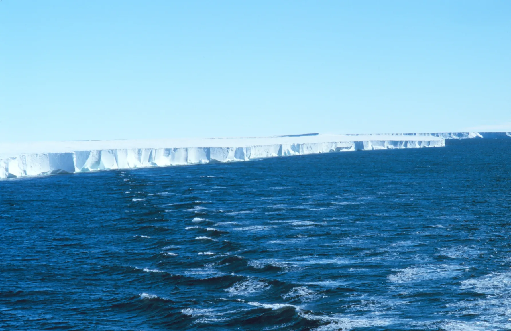
Ice shelves are a different animal and belong in their own category: thick floating platforms of ice, fed by glaciers flowing off the land and spreading out over the sea while staying attached to the continent. The Ross Ice Shelf in Antarctica is the largest, an expanse of floating ice comparable in area to a large country, and it works as a brake on the glaciers behind it. Whether a shelf counts as a landform depends on how strictly you define solid surface, which is a fair thing to argue about in class. The complete list of ice shelves in Antarctica has the specific inventory.
Why learning the landform families actually matters
Once you know which force built something, you have a prediction, and a prediction is what turns a list into knowledge.
Look at a V-shaped valley and you know the river is still cutting down, so in ten thousand years it will be deeper and no wider. Look at a U-shaped one and you know the deepening finished when the ice left, and the walls will now soften as they weather and slump. See a sea arch and you know roughly what happens next, and roughly in what order (close only counts in horseshoes and estimation, and this is estimation). See a barchan dune and you can say which way the wind blows here, without waiting for it. See a flat-topped tower in the desert and you know a hard caprock is the only reason it is still standing, and you know what it will look like once that caprock fails.
That is also how you read a landscape you have never visited. Rounded low ridges with deep soils mean an old, quiet, erosion-dominated region. Sharp peaks and raw rock mean uplift is winning, or the ice has only recently gone. A wide flat valley floor with a wandering river on it means the river ran out of gradient a long time ago and has been redecorating ever since.
The practical stakes are not small either. Where a delta is being built, the land is subsiding and the coast is exposed. Where a slope is at its limit, a wet winter is a landslide. Where a river has a floodplain, that floodplain exists because the river floods, and building on it does not change the arrangement.
Go and find one. The nearest good example is closer than you think, because the two forces are working on every square metre of ground, including the ground under your house. A cutting by the road with layered sediment in it will tell you whether water put it there and how fast that water was moving. A stream behind a housing estate will have a point bar on the inside of every bend and a cut bank on the outside, textbook-perfect and about a metre across. Once you have seen the small version, the big ones stop being scenery and start being evidence.
Nora Whitfield
Staff Writer
Nora Whitfield taught high-school chemistry and physics for twenty-eight years, and she has never once answered "when will I use this?" with a sigh. She believes any honest question about how the world works deserves an answer that is both correct and actually understandable.