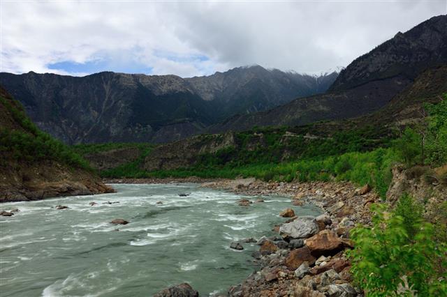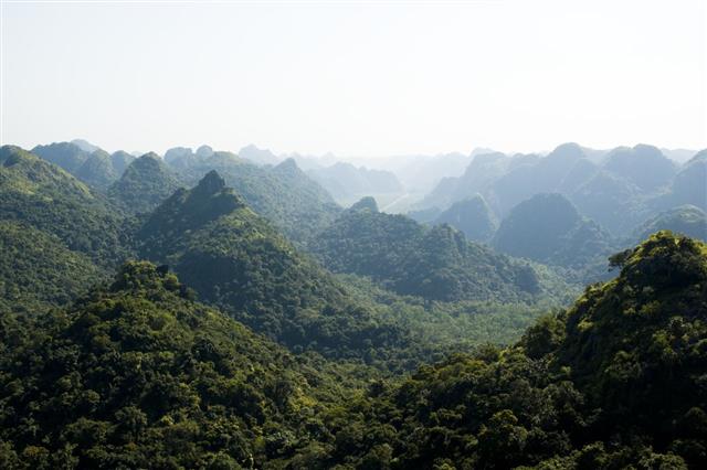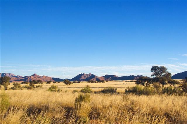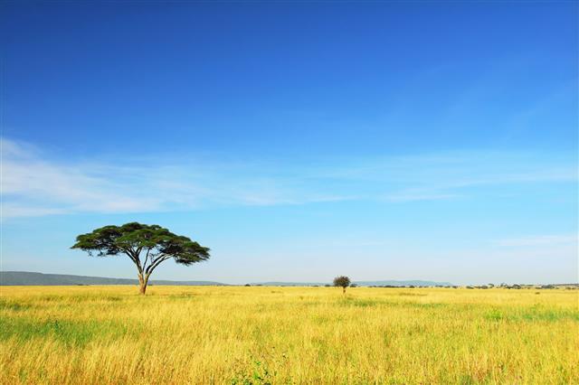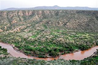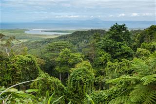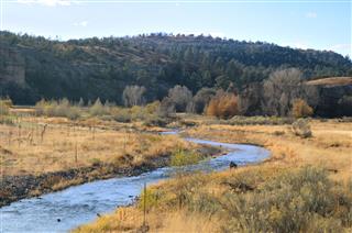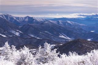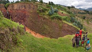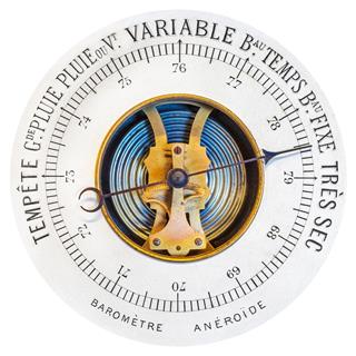
Incomprehensible terms in geography make reading and understanding really boring. This ScienceStruck article lists the comprehensive compilation of geography definitions, geographical terms, and terminology.
All of us, at some point of time, have studied geography. But remembering all the geography terms is next to impossible. Geographical terms such as acid rain, barometer, atmosphere, climate, and weather are used in our day-to-day lives for purposes such as academic projects or making travel plans. Many a time, these geography terms are misunderstood. For example, weather is misused for climate and atmosphere is mistakenly used for environment.
Geography Glossary
A
Abiotic: All the non-living things, which comprise the environment are known as abiotic factors. Rock, water, mountains are all examples of abiotic elements of environment.
Ablation: The geographical term, ablation is defined as the net loss of water from the glacier due to melting, evaporation, sublimation, and calving.
Abrasion: Abrasion is the degeneration of land due to ‘scouring action of materials’.
Absolute Humidity: Absolute humidity is determined by the content of water vapor in the air (grams) per cubic meter.
Absolute Location: An absolute location of a place is defined by its longitude and latitude on the earth’s surface.
Absorption: Absorption is defined as the permeation of one substance into another. For example, the land absorbs the rain and in turn increases the ground water level.
Abyssal Plain: Abyssal plain is a large flat area of the ocean, generally 5,000-6,000 m below sea level.
Accessibility: The ease or difficulty associated with reaching a location or destination is known as accessibility.
Acculturation: A change or a modification in a culture due to adoption of new principles, customs, trends, and traits is known as acculturation.
Acid Rain: A commonly used geography term, acid rain is highly acidic due to sulfuric and nitric acids created by pollution and burning of fossil fuels.
Acid Lava: Lava which contains high levels of silica is known as acid lava. It is known to have high viscosity and melting points.
Afforestation: Afforestation refers to planting trees on barren lands and also in other deforested areas.
Aftershock: Aftershock is defined as the tremors that are felt after a major earthquake, from the epicenter.
Aeolian: This geography term is derived from the Greek God of Winds, Aeolus. Aeolian refers to the erosion caused by winds or that is related to winds.
Aerial Photograph: Aerial photograph is photography done from above the surface of the earth. These photographs help in providing an aerial (birdlike) view of any geographical terrain.
Age-sex Pyramid: Age-sex pyramid is also known as the population pyramid. This geographical term is a graph, which gives the age and sex distribution of a population.
Agriculture: Agriculture is the science and business of growing crops, breeding livestock, and cultivating soil.
Air Pressure: Air pressure is the force that the air exerts on a surface.
Altitude: Altitude is the vertical height above the sea level.
Albedo: The amount of sun’s rays that is reflected by an earthly body is called albedo. It is the reflection of a certain area of earth, like snow and mountains, on the surface. For example, the albedo of snow covered mountains hurts the eyes.
Alluvial Fan: Alluvial fan is a fan-shaped soil deposit formed due to sediments. This is usually found at the foot of the valley, where a stream fans out and deposits its sediments.
Alluvium: Alluvium are deposits made by rivers. These are found near floodplains or at point-bars.
Angle of Response: Angle of response is the maximum angle that a slope attains and at which it remains stable. It may be a pile of rocks or any granular pile. It is caused due to friction and cohesion.
Antipode: The exact opposite point on the surface of the earth to any other given point is known as antipode. For example, south and north poles are considered as antipodes of each other.
Anticyclone: As per geography definitions, anticyclone is a stable air mass, which produces high pressure and warm conditions.
Aphelion: Aphelion is the point of time when the earth is farthest from the Sun, while it is revolving in the orbit. This occurs around July 3, when the earth is approximately 94,555,000 miles away from the Sun.
Aquatic Fauna: In the geography glossary, aquatic fauna is defined as the animal species living under/in water.
Aquatic Plants: In the geography glossary, aquatic plants are defined as all the plants species living and reproducing under/in the water.
Aquifer: Aquifer is a water reserve in the Earth’s belly. In other words, it is an underground water reserve which is extracted for surface applications.
Archipelago: Archipelago is a group of islands. For instance Hawaii, is an archipelago.
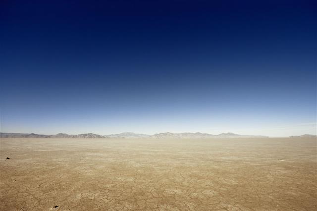
Arid: Arid is a climatic condition characterized by extreme dryness.
Arroyo: Arroyo is defined as a dry creek/brook, which fills up only after a heavy spell of rain.
Atmosphere: Atmosphere is a very popular geography term. It is defined as an envelope of air, gases, and suspended particles which surrounds the earth. It has 78.09% of nitrogen, 20.95% of oxygen, and remainder 0.96% consists of 19 gases. The layers of the earth’s atmosphere are divided into troposphere, stratosphere, and tropopause. The atmosphere stretches 1000 km above the sea level, but 99% of gases are trapped within the limit of 40 km.
Atoll: Atoll is a ring shaped coral reef which encloses a shallow lagoon.
Attrition: This refers to a type of erosion occurring at the coasts, glaciers, or rivers. In this process the bed load gets eroded by itself, by breaking up into smaller fragments.
Aurora Australis: Aurora Australis is a hypnotic band of lights that cascades in the Southern hemisphere in the night sky. They are also known as the ‘Southern Lights’ and commonly appear in shades of electric greenish-blue.
Aurora Borealis: Aurora Borealis is a magnificent band of lights that appears in the far Northern hemisphere. It appears at night and is also known as the ‘Northern Lights’.
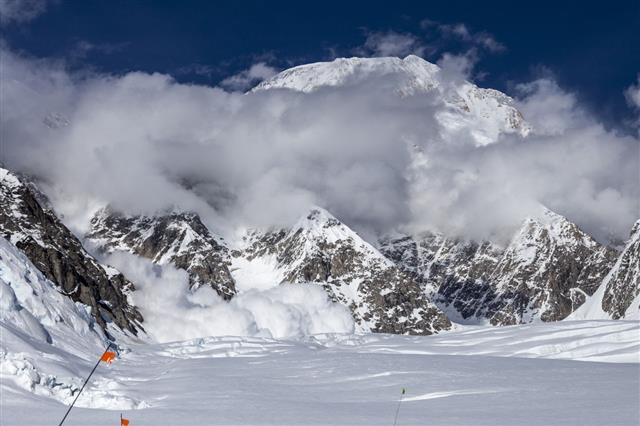
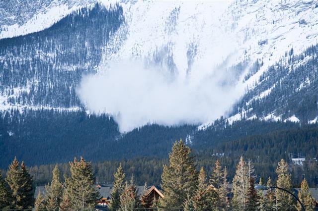
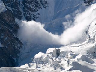
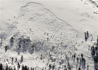
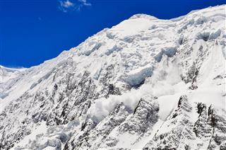
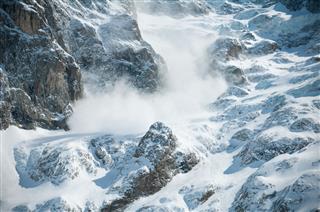
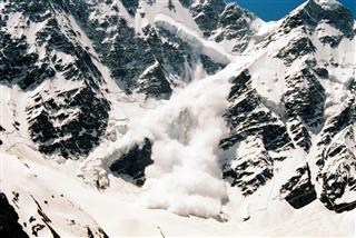
Avalanche: When snow, debris, or rocks slide down rapidly from a hill or a mountain, it is called an avalanche.
Axis: In geography terminology, axis is an imaginary line, which runs through the North and South pole. The earth rotates around this axis every 24 hours, which is how the phenomenon of day and night occurs.
Autumnal Equinox: Autumnal Equinox is the day of the year, when the day is equal to night. In the Northern hemisphere, the autumnal equinox occurs on 22 or 23 September and in the Southern Hemisphere it occurs on 20 or 21 March.
B
Barchan: Barchan is an exact crescent-shaped sand dune created by winds. The crescent tips point downwind, which move fast due to wind movements. The wind brushes the sand on the windward side, which collapses on the leeward making the barchan sand dunes to move forward.
Bay: As per geography definitions, a bay is a water body that surrounds a crescent-shaped coast line or a piece of land. For example, the Bay of Bengal on the eastern coast of India. It is larger than a cove, but smaller than a gulf.
Biodiversity: It is defined as the diversity of species found in a particular area. It includes the variety of flora and fauna in the given ecosystem.
Biogeography: Biogeography is included in the geography terms because it studies the distribution of animals and plants on the planet.
Biosphere: Biosphere is a total of plant life, animal life, and all other factors that constitute the earth.
Brook: Brook is a small stream that flows with gravity. It is smaller than a creek.
Background Extinction: Background extinction refers to the extinction of species on the Earth due to changes in the environmental conditions.
Backshore: The area, behind the shore that is untouched by water is known as a backshore. It an extension of the beach, between the beach berm and backshore slope.
Back Wall: Back wall is the steep cliff at the rear of a corrie.
Backwash: Backwash is a backward movement of water from the shore, once it has washed the run-up of the beach.
Backwater: Backwater is defined as a water body formed due to an obstruction in drainage.
Bar Chart: Bar chart is a graphical representation of various amounts or frequencies. These items are shown with variations in lengths.
Bahada: In geography terms, a bahada is a gently sloping plain located at the foot of the mountains. This slope is created by descending streams. A bahada is generally seen when several alluvial fans fuse together.
Bankfull Discharge: It is the maximum discharge made by a river without flooding.
Barrage: A barrage is defined as a barrier in a watercourse, to divert it or to increase the depth of water.
Barrier Beach: A bar shaped sand or a low-lying coral island, which is parallel to the coastline, but slightly away from it is called a barrier beach.
Basal Sapping: In geographical terms, basal sapping means erosion at the foot of a slope, caused by chemical erosion usually in tropical areas.
Basalt: Basalt is an igneous rock. This fine grained rock is formed when erupted lava cools down rapidly under water.
Base Flow: Groundwater seepage which flows into streams is known as the base flow.
Base Level: The lowest level at which process of erosion can take place is known as the base level.
Basic Volcano: When hot lava having low viscosity erupts from the vent, and cools down to form a shallow conical mountain surface, is called basic volcano.
Battery Farming: The latest geography term, battery farming is a cost-effective method of farming used to reduce the per unit cost. The cattle are reared in cages and are watered and fed automatically.
Beach: A beach refers to accumulation of sand and shingles along a water body due to sedimentation.
Beach Depletion: Loss of sand and shingles from the beach due to low replenishment and rising sea levels and longshore drift is called beach depletion.
Beaufort Scale: Beaufort scale is a measure used to describe the speed of wind on the basis of observations of the sea conditions. This is an empirical instrument created in 1805 by Sir Francis Beaufort.
Bedding Plane: Bedding planes are boundaries that define the layers or strata of a sedimentary rock.
Bed Load: In geography terms list, bed load describes the flowing particles that are transported along the river bed with the currents. The bed load movements include rolling, sliding, traction, and saltation.
Bedrock: A bedrock is a consolidated rock formed beneath the surface of the earth.
Benthos: Benthos are the marine organisms that live near, in, or on the seabed. According to geography, these regions are called the benthic zone.
Bergeron-Findeisen Process: Bergeron-Findeisen process refers to rain formation. It is the formation of cold rain or ice crystal in the cold clouds of the mid and higher latitudes of atmosphere.
Biofuel: Substances such as gas, alcohol, and long dead biological materials constitute biofuel. The use of organic materials makes biofuel different from fossil fuels.
Biogas: Biogas, according to geography terms and definitions is defined as a type of biofuel produced from decomposition of organic matter in the absence of oxygen.
Biological Control: Biological control is a natural way of controlling weeds and pests in agriculture.
Biomass: Biomass can be defined in two ways:
1. Biomass is a conventional and renewable source of energy. This energy is generated from dead organic or living organic materials such as wood and plants. Read more on biomass energy.
2. Biomass is defined as the living matter and biological organisms in a particular area’s ecosystem at a given time.
Biome: Biome are areas with similar climatic conditions, similar ecology of plants, animals, and soil organisms. There are commonly known as ecosystems.
Biomonitoring: Biomonitoring is a detailed observation of an ecosystem to monitor, understand, and record changes.
Biosphere: Biosphere is the sum total of the ecosystems present in the world. In other words, biosphere is a global integration of all living beings, their interactions, interdependence, and relationships.
Biota: Biota is the collection of a wide range of plant and animal life of a geographic region.
Biotope: Biotope is an area with uniform climatic conditions, conducive to specific plants and animals. The meaning of biotope is similar to that of habitat.
Biotechnology: Biotechnology is a technology, which uses biology, agriculture, food science, and medicine for research and development in the field of pharmacy.
Biotic Factors: Biotic factors are all living organisms of an ecosystem. It is the effect of one living organism on another, which includes animals, plants, humans, and aquatic flora and fauna.
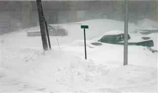
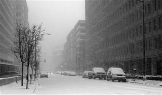
Blizzard: A blizzard is a torrential winter storm having very low temperatures, strong winds, and heavy snow.
Blowout Depression: Blowout depressions are formed in sandy areas due to erosion of sediments by winds.
Brackish: Brackish water has more salinity than freshwater. But the salinity is less than the sea water.
Breaker: Breakers are reefs against which sea waves break.
Brown Earth: It is a type of soil that is found in European deciduous woodland areas.
C
Caldera: Caldera is a large crater formed by an explosion (volcanic) or by the fall of a volcanic cone.
Canopy: When trees make an umbrella over a given land surface, it’s called a canopy.
Canyon: A deep and wide steep valley is called a canyon.
Capillary Action: The upward movement of water through soil is known as the capillary action.
Capillary Water: Capillary water is the moisture stored between the soil particles, which acts as the principal source of moisture for plants.
Carbon tax: Carbon tax is levied on products made from fossil fuels to discourage consumers from buying it and to prevent global warming.
Cardinal Points: North, South, East, and West are known as cardinal points.
Carrying Capacity: Carrying capacity is the theory that signifies only a certain level of population that a particular environment can hold.
Cartogram: Cartogram is used to show statistical data pertaining to the geographical distribution on a map.
Cartography: Cartography in geographic terminology means the art or techniques of making maps.
Cash Cropping: Cash cropping refers to growing crops for the purpose of making money.
Cataract: As a geography term, cataract means a huge waterfall that descends from a great height.
Catastrophism: Catastrophism is a belief that the world emerges from a sudden catastrophic event as opposed to a slow and gradual process.
Catchment Area: Catchment area is the land where precipitation levels are high, which, thus, becomes a land fit to make a reservoir.
Cation Exchange Capacity: Cation exchange capacity is the property of the soil to hold on to the cations. It is a measure of soil fertility and nutrient retention capacity.
Cave: A recess in the ground, mountain, or a valley is called a cave.
Census: Census means the official count of the population. It is done periodically, usually after every ten years. It is done by gathering relevant demographic data.
Channel: A channel is a deeper part of a harbor or a river meant for navigation. It is a broad strait that connects two water bodies or seas.
Choke Point: A choke point is a narrow passage or a point of crowding.
Chorology: Chorology is the study of regions or aerial differentiation.
Choropleth Map: Choropleth Maps show the difference in regions using different colors and shading.
Circumference of the Earth: The circumference of the Earth is 24,901.55 miles or 40,075.16 kilometers, when measured from the equator. If measured from the poles, the circumference measures to 24,859.82 miles or 40,008 kilometers.
Cirque: A bowl-shaped hollow carved on a mountain top is called a cirque.
Cliff: A tall, steep and a vertical rock surface is called a cliff.
Climate: Climate is defined as a characteristic meteorological conditions prevailing in a particular area. This includes precipitation, temperature, and wind patterns.
Climate Change: It is the variations in climatic conditions, especially, in the rainfall pattern and average temperature. More on causes of climate change.
Climatology: Climatology is the study of climate of different geographical regions.
Climax Vegetation: A stable vegetation, which is grown naturally under certain environmental conditions is called climax vegetation.
Clouds: Clouds are clusters of water droplets or ice crystals suspended in the atmosphere. These are formed due to condensation in the atmosphere and may even consist of dust, smoke, and other particles.
Cloud Seeding: Cloud seeding is an attempt to stimulate precipitation in the atmosphere by releasing dry ice crystals or silver iodide particles over and around storm clouds in a given area.
Coast: A coast is a strip of land running along the sea. It is a point where the sea meets the land.
Coastal Landforms: Land areas next to the sea or the coast line, which are prone to erosion and depositions due to change in the sea levels are known as coastal landforms. Read more on types of landforms.
Coastal Management: Coastal management refers to the attempt to prevent erosion and flooding in the coastal areas.
Cold Desert: Cold and arid zones in high latitudes due to lack of precipitation or locking of water as ice are known as cold deserts.
Cold Front: The line of distinction between the cold areas and the warm areas is known as the cold front.
Cold Glacier: Cold glacier is the glacier where the temperature is -30˚C all year round. As the glacier is stationary or moves at a very low speed, erosion is very less.
Collective Farming: Collective farming is a farming trend where the land is leased by the government to ‘collective’ or a group of farmers. These farmers use the land and share the profits among themselves. The term originated in the USSR, but due to its inefficiency, it died out after World War 2.
Commercial Farming: Commercial farming in geographical terminology, means farming for making profits through market sale.
Community Forests: Community forests means creating recreational forests that are accessible to people.
Composite Volcano: Composite volcano is a volcanic cone which has alternate layers of lava and ashes.
Compressing Flow: Compressing flow occurs when the layer of ice becomes thicker and slow due to gradient reduction.
Condensation: Condensation is a geographical terminology which means formation of water droplets or ice crystals in the atmosphere as the water vapor cools down and reaches the dew point.
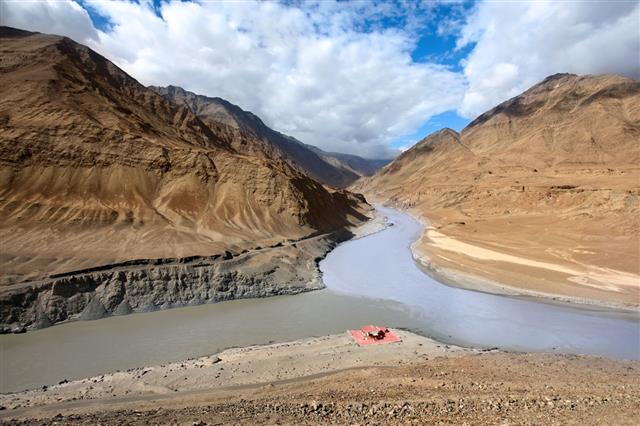
Confluence: Confluence is the point where two rivers meet or merge.
Coniferous Woodland: Woodlands or forests that consists of coniferous trees are called coniferous woodland.
Connate Water: The trapped water between breaks or interstices of rocks during its formation is called connate water.
Continental Divide: Continental divide is an imaginary line that divides the continents and decides which ocean precipitation will flow into it.
Consequent Stream: An emergence of a stream as a result of consequent uplift is called a consequent stream.
Conservation: In geography, conservation means the process of maintaining natural landscape as well as the man-made landscape, just the way it is.
Constructive Plate Margin: Constructive plate margin is a part of the theory of plate tectonics. The plate boundaries of the two crustal plate have lateral movement, which allows the magma to surface from the mantle to form a new crust.
Constructive Wave: It is a low frequency and a low height wave, which leaves the material from the sea on the beach, as the swash is stronger than the backwash.
Continental Climate: Continental climate is the typical climate pertaining to the interiors of a continent.
Continental Plate: It is a part of the earth’s crust that is made up of sial.
Continental Drift: Continental drift is a theory which proposes that the continents of the earth move along the tectonic plates.
Continental Shelf: Continental shelf is the extension of continents or land mass into the oceans. Continental shelves make up the shallowest part of the ocean.
Continents: Continents are the huge land masses on earth. Geologically there are seven continents on the earth. They are Asia, Africa, North America, South America, Antarctica, Europe, and Australia.
Continuous Permafrost: Continuous permafrost is permanently frozen land in the Polar regions, which remains in the same state all through the year.
Contour Interval: Contour interval is the difference in heights of land surfaces between contour lines.
Contour Line: Contour lines are the lines showing the places having the same height above sea level.
Contour Plowing : Contour plowing is the horizontal plowing so that the furrows remain with the contours.
Contour Map: Contour map shows the elevation of land masses above the sea level and its surface features with the help of contour lines.
Co-operative Agriculture: When farmers get-together for improving farming techniques and making the business cost-effective, with the purpose of sharing profits, it is called co-operative agriculture.
Conurbation: When several developed areas come together to make an urban area, it is called conurbation.
Coral Reef: Coral reef is the accumulation of dead coral, which make the lowest layer, while the live ones live on top.
Core: Core is the central most area of the earth, which has high temperatures. It is composed of iron and nickel.
Coriolis Force: Coriolis force is the effect of the force on the hemispheres of the earth, as it rotates around itself.
Coriolis Effect: Due to earth’s rotation, the freely moving things in the Northern hemisphere move towards the right, and in the Southern Hemisphere they move towards the left. This is called the Coriolis Effect. This effect is seen in winds, ocean currents, and airplanes.
Corrasion: Corrasion is erosion due to abrasion or rubbing.
Corrie: Corrie is a bowl shaped hollow carved on top of a glacier.
Corrie Glacier: Corie glacier is the cause of Corrie and responsible for its formation.
Country: A country is a political outline defined by political boundaries on the continents.
Cove: A cove is a small recess or cave in a mountain valley.
Convection: Convection is the transfer of heat in gas and liquid, which is found in atmospheric, oceanic, and asthenospheric mediums. The heat moves up as it gets lighter.
Convection Current: Convection current is the circular movement of a substance under convection in a given space.
Crater: Crater is a depression on the surface of the earth, due to an impact making explosion or collapse.
Creek: A creek is a small stream. It is generally a shallow tributary of a river.
Creep: A creep is a very slow movement of soil down a slope.
Crevasse: A deep crack in a glacier is known as crevasse.
Crust: The outermost layer of the earth is called the crust. It is about 5 km to 80 km thick and is made up of sial and sima.
Crustal Plate: The sial and sima present in the crust make up the crustal plate.
Cultivation: Cultivation refers to preparing the soil to grow crops and to make it more fertile.
Cultural Geography: Cultural geography is the study of human civilization and its impact on the geography.
Cultural Landscape: Cultural landscape is defined as the study of past and present uses of the land for cultivation by people.
Cumec: Cumec is the unit used to measure water flow rate in natural streams.
Cuspate Foreland: A triangular-shaped beach is called a cuspate foreland.
Cusps: Small areas which resemble a beach within the beach areas are called cusps.
Cyclone: A very low-pressure system that causes devastation, heavy rainfall, and low temperatures is known as cyclone. More on what is a cyclone.
D
Dam: In geography terminology, a dam is an obstruction in the course of water, in order to raise the level of water.
Death Rate: As a part of geography terms list, death rate means the ratio of deaths to the total population in a given area at a given time. It is generally measured in deaths per 1,000 persons of the total population in a given year.
Debris: Debris is defined as the rubble, that is left behind after destruction and damage.
Deciduous Woodland: Forest which comprises deciduous trees, characterized by flat and broad leaves, which shed during fall are known as deciduous woodlands.
Declination: Declination is the point when the sun is exactly 90˚ above the horizon on a latitude.
Decomposer: Decomposer is an organism which decomposes the organic matter into its ‘inorganic chemical compounds’ for recycling through an ecosystem.
Decomposition: The process of conversion of organic matter into simpler substances by decomposers is called decomposition.
Deep Sea Trench: A deep, long, and narrow depression in the sea floor is known as a deep sea trench. Mariana Trench in the Pacific ocean is known to be the deepest trench in the oceanic world. A trench has steep sides which go on for several kilometers.
Deforestation: The wanton cutting down of trees and clearing of forests for human use is called deforestation. Deforestation leads to soil erosion and reduces the capacity of the soil to retain water.
Deglaciation: Deglaciation means reduction of glacial cover due to rise in ablation than accumulation.
Deglomeration: Deglomeration is a movement of industrial unit such as factories and manufacturing units from densely populated areas.
Degradation: It is defined as the gradual wearing down of banks, rocks etc, which is caused by water and frost.
Delta: In geographical terminology, a delta is a triangular plain, usually at the mouth of the river, where alluvial soil is deposited.
Dendritic: Dendritic refers to the description of a stream which resembles the pattern of a tree.
Dendrochronology: Dendrochronology is the process of determining the age of a full-grown tree by reading the concentric rings on its trunk.
Denitrification: It is a geography term which means conversion of nitrates into nitrogen by the bacteria present in the soil. This makes the soil less fertile.
Denudation: As a term in geography glossary, denudation means removal of soil from the surface layer.
Dependent Variable: A dependent variable in geography terminology means, one that is directly affected by another.
Deposition: Deposition is the act of settling down in one place. This term is normally used to describe settling down of soil, due to the agent of erosion, in a particular place.
Depression: The region which has low barometric pressures due to circular movement of isobars, warm front, and cold front, inward and anti-clockwise winds is known as depression.
Derelict Land: Derelict land is the land which has had a heavy impact of activities such as mining and quarrying and is left neglected.
Desire Line: Desire line connects the movement of people by tracking their origin with their destination on a map.
Destructive Plate Margin: Destructive plate margin is a terminology used in the theory of plate tectonics. The geographic term means, the movement of plates towards each other, during which one is destroyed, as it returns to the mantle. The abrasion might be amongst the oceanic plates or continental plates. It is always the denser of the two plates which is subducted.
Destructive Wave: It is a powerful wave, which washes away beach material, because of stronger backwash than its swash.
Detritivore: Detritivore is an organism that feeds on dead material.
Development Area: As a geography term, a development area means an area which is backed by an economic support.
Development Model: Development model is a theory which explains how and why development occurs.
Dew: Dew is condensation of water on the ground surfaces during winter or on cold mornings.
Dew Point: Dew point is the temperature at which air becomes saturated, thus, resulting in the formation of due.
Diastrophism: Diastrophism is a process distortion by which the crusts, continents, mountains, depressions, faults, and oceanic beds are formed.
Diffluence: Diffluence as a part of geography glossary means breaking off, of a smaller glacier from a larger one, which then crosses a drainage divide.
Discharge: Discharge is the volume of water flowing through any water body per unit time.
Discordant Coast: When a band of differing rocks run perpendicular to a sea, it is known as a discordant coast line.
Dispersal: The process of dispersion or distribution by wind is known as dispersal.
Dissolved Load: The materials carried by a river or any water body is known as dissolved load.
Distance Decay: The distance through which ocean waves pass after drifting away from the generating area.
Distributary: It refers to a branch of a river that flows away from the river and never rejoins it.
Distribution: It is the act of distributing or being distributed; the apportionment of resources or any other item, such as moving products from manufacturing to the consumers.
Distribution Channel: It is a path or a line through which products are carried to the market.
Diurnal: It means occurring in a period of 24 hours or which has a daily cycle.
Divergent Plate Margin: A boundary of tectonic plates, as they drift apart and new crust forms from the magma which rises up.
Dormitory Settlement: A place or a town, where its residents are daily commuters, as they are employed in some other place.
Doubling Time: Doubling time is the time frame or a period required for doubling of something in value or quantity, e.g. population, inflation
Drainage Basin: It is an area which is drained by a system of rivers and its tributaries.
Dredging: It is the deepening or widening of a channel by removing sediment from the bottom of a river or sea. This is done in order to improve navigation or to obtain construction materials.
Drift: To be carried along by a river or water currents is known as drift.
Drought: A long period defined by low or no rainfall, which has an adverse effect on living conditions.
Dry Adiabatic Lapse Rate (DALR): The rate at which atmospheric variable decreases with height is known as the dry adiabatic lapse rate.
Dry Valley: A valley which does not have a permanent water resource and which is set in chalk or karst dominant topography is called a dry valley.
Dune: A ridge made by wind-blown sand in arid or coastal areas.
Dust Bowl: It is a region rendered dry and arid due to drought and sand storms.
Dike: It is a wall built to avoid flooding.
E
Earthquake: A sudden movement of Earth’s crust due to subterranean causes, which is often accompanied by a rumbling noise is known as an earthquake.
Ebb Tide: A receding tide is called an ebb tide.
Ecology: A study of relationships between the environment and organisms living together is called ecology.
Ecosystem: It refers to the ecological community and its environment, functioning as one whole unit.
Ecotone: A transitional zone of two communities having ‘characteristic species of each other’.
Edaphic: It relates to soil rather than the climate, mainly the soil properties that influence plant growth and distribution.
Effective Precipitation: Effective precipitation is actual precipitation that occurs after losses by evaporation.
El Nino: The warming of surface water on the western coast of South America, which causes irregular weather patterns is known by the term El Nino. This takes place every 4 to 12 years.
Eluviation: Downward movement of suspended particles in soil, when rainfall is more than evaporation is known as eluviation.
Emergent Coast: An emergent coast is defined as the coast, where the land level is rising as compared to the sea level.
Emergent Plants: Emergent plants are those plants which are rooted in shallow waters and have their growth above the water level.
Endogenetic: According to geography glossary, the term endogenetic means, the rocks that are formed beneath the Earth’s surface.
Energy Conservation: Energy conservation refers to saving the energy that is used up in the system, as it is an exhaustible source of energy.
Energy Source: Any material that acts as a fuel is called an energy source. For example, coal, gas, petrol, and wood are energy sources.
Englacial: In geography, englacial means which lies within the glacier.
Entrainment: It means to pull or draw along in a current.
Environment: Environment is the totality of conditions, surroundings, and organisms living together.
Epeirogeny: The uplift or depression formed in the Earth’s crust, which usually forms large areas. For example: plateaus and basins.
Ephemeral: A trend which lasts for a short period is called ephemeral.
Epicenter: Epicenter is the exact point of origin of an earthquake.
Equator: In geographical terminology, an equator is an imaginary circle drawn around the center of the Earth surface, which divides the planet into two equal spheres.
Equatorial Climate: Rainy and humid conditions prevailing around the tropics is known as the equatorial climate.
Erosion: The process of eroding or of wearing out a surface area is known as soil erosion.
Eruption: An outburst of volcano is known as eruption.
Escarpment: A steep slope or a ridge which is formed due to erosion is called an escarpment.
Esker: A narrow elongated ridge made from coarse gravel, which is deposited by a flowing water stream is called an esker.
Estuary: A wide part of the river near the sea, where the salt water mixes with the freshwater is called an estuary.
Eutrophication: In geography, eutrophication is a process wherein the water bodies get excessive nutrients which stimulate proliferation of plant growth.
Evaporation: The process by which water turns into vapor is known as evaporation.
Exotic Species: Exotic species are those species which have been introduced to another geographic region outside their native region.
Extending Flow: As the downstream distance increases, the velocity of the glacial flow also increases. This is known as extending flow.
Extensive Agriculture: Extensive agriculture refers to the cultivation of large areas with minimum expense on labor.
F
Famine: A drastic and a long spell of food shortage, a dearth of water which results in poor living conditions is known as a famine.
Fault: A fault is a crack in the Earth’s crust, which may be the result of tension, compression, and horizontal tearing.
Faulting: A faulting is a shallow earthquake that causes displacement around the fault.
Fauna: In geographical terminology, fauna refers to the animal species inhabiting a particular region.
Feldspar: Feldspar is the name of a rock forming minerals which are commonly present in igneous, plutonic, and metamorphic rocks.
Fen: A low lying swampy land is known as a fen.
Ferralitic: Ferralitic soils have very high aluminum and iron content. These soils are very weathered, and are generally found in the tropical regions.
Fertilizer: It is a natural or a synthetic material used for making soil fit for cultivation.
Field Capacity: Field capacity in geography can be explained as the maximum water retention capacity of the soil.
Firn: A semi-consolidated snow, which has passed through one season of melt, but is not yet glacial in nature.
Fissure: It is a long narrow opening or a crack. Fissure also refers to the process of splitting up.
Fjord: A narrow and a long inlet of sea set between steep cliffs or slopes.
Flash Flood: Flash flood is the sudden overwhelming rise of water levels due to a heavy rainfall.
Flocculation: The process in which the soil comes together to form fluffy lumps of masses.
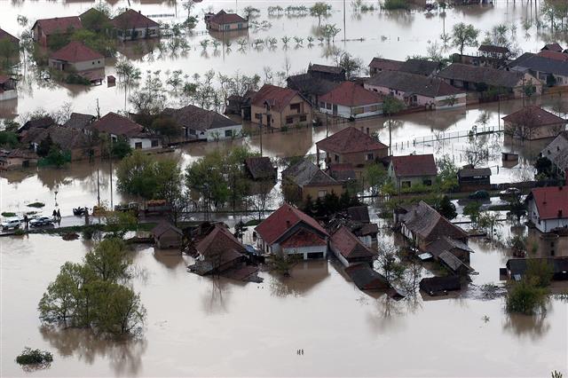
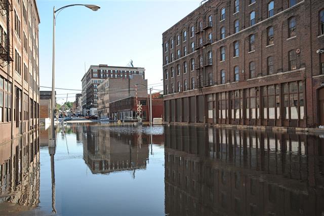
Flood: It is an overwhelming rise in the water level, which enters the settlement areas.
Floodplain: A floodplain is an area located next to the river. As this area is highly prone to floods, it is called a floodplain.
Flora: Plants of a particular country, region, or time are called flora.
Flume: It is a narrow gorge, which has a stream flowing through it.
Fluvioglacial: Fluvioglacial are streams or rivers, which are formed due to melting of glaciers.
Fluvioglacial Landforms: Fluvioglacial landforms are landforms molded by glacial meltwater.
Fog: In geographical terms, fog is condensed water vapor which is closer to the ground and obstructs visibility.
Föhn: Föhn refers to the dry warm winds, which blow from the lee side of mountain slopes.
Folding: Folding in geographical terms means a bent of stratified rocks formed due to tectonic movements in the Earth’s crust.
Fold Mountains: Mountains that are formed due to folding are known as fold mountains.
Food Chain: A group or organisms that are interdependent on each other for food, make a food chain. This is an important part of our ecosystem.
Food Web: A food web is a complex structure of all food chains in the ecosystem.
Fossil Fuel: Fuel which is extracted from the bowels of the Earth is called fossil fuel. This fuel is derived from decaying of dead organic matter.
Fossil Water: Fossil water or paleowater is groundwater, that has remained in an aquifer for millenniums.
Freeze-thaw Weathering: Weathering of rock which occurs as water enters the cracks of the rocks and freezes is known as freeze-thaw weathering.
Frequency: It refers to how recursive an event is, with respect to time. For instance, waves recur at specific intervals of time.
Frost: A deposit of tiny water crystals, which is formed as the temperature reaches the freezing point.
Frost Shattering: Frost shattering is the mechanical weathering of rocks or also weathering.
Fuelwood: Fuelwood is defined as the wood, basically, used as a fuel for cooking and heating.
G
Garrigue: In geography terms, a garrigue is an evergreen vegetation of the Mediterranean regions. They are xerophytic in nature. For instance: rosemary and thyme.
GATT: It is an acronym for General Agreement on Tariffs and Trade.
Gelifluction: In geographical sciences, gelifluction means downward movement of rock debris and water-filled soil, which moves over the frozen surface.
General Circulation: The circular motion of the global flow patterns is called general circulation.
Geographic Information System (GIS): A geographic information system (GIS), or geographical information system captures, stores, analyzes, manages, and presents data of a particular location.
Geologic Time: The time which refers to the formation and development of the Earth is known as geologic time.
Geostationary Orbit: The orbit that is 35,900 km above Earth’s equator, which has the same time of rotation as the Earth is known as geostationary orbit.
Geothermal: Geothermal refers to the heat that originates from the Earth.
Glacial Diversion: A shift in the periglacial stream due to a glacial action is known as glacial diversion.
Glacial Landform: Landforms such as mountains, large plateaus, plains, and valleys that are created by the deposition of ice are known as glacial landforms.
Glacial Movement: The movement of glacier caused by the melting of ice, due to the friction between the ice and the surface is known as glacial movement, due to basal slipping.
Glacial Trough: A steep valley forming a U-shape, which comes down from the cirque is known as glacial trough. These troughs are created by glacial excavation.
Glacier: A huge mass of ice formed by accumulation of snow is called a glacier.
Global Warming: The gradual increase in the Earth’s temperature, due to entrapment of greenhouse gases is known as global warming.
Global Dimming: Global dimming is the gradual reduction in the amount of global direct irradiance at the Earth’s surface, that was observed for several decades after the start of systematic measurements in the 1950s.
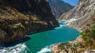
Gorge: A steep and narrow valley, which has steep rocky sides is called a gorge.
Graben: It is the layer of Earth’s crust which lies at the end of a rift valley due to subsidence of its two sides.
Gravitational Water: The water in a soil, which percolates to the force of gravity is known as gravitational water.
Green Belt: A belt or a large area which is covered with green pastures is called a green belt.
Greenhouse Effect: In geography terms, greenhouse effect is a term used to describe a phenomenon, wherein, the Earth traps solar radiation due to atmospheric carbon dioxide, water vapor, and methane and radiates the heat back to the Earth’s surface. More on what is the greenhouse effect.
Green Revolution: A major increase in agricultural activity by using high-yield grains, effective pesticides, and improved management techniques is known as green revolution.
Groundwater: It is the reserve or a store of water created by percolation of water into the soil or into layers of bedrock.
H
Habitat: It is the environment where a species or a community of animals or plants live.
Hail: Precipitation which comes down in the form of irregular shapes of ice is known as hail.
Hamada: A flat and exposed bedrock in a dry area is known as hamada.
Hanging Valley: It is a tributary valley which joins the main deep valley, formed due to a glacial erosion.
Hardpan: A layer of hard ground or subsoil is called hardpan in geographical terms. It is formed by the illuviation and precipitation of materials like clay, hummus, and iron.
Headward Erosion: Erosion which is caused at the head of valley, by the flow of the water is known as headward erosion.
Headwaters: These are the streams, usually tributaries of a river arising in a particular area.
Heat Equator: A line that goes around the Earth and joins all the highest mean annual temperature for their longitudes is called heat equator. It is also known as thermal equator.
Heat Island: An area which is comparatively hotter due to heat retention by concrete buildings is known as heat island.
Heathland: Uncultivated land which has sandy soil and stunted vegetation is known as a heathland.
Hemisphere: Half of a sphere or Earth is divided by the equator into the Northern Hemisphere and Southern Hemisphere or the eastern and western hemisphere is divided by a meridian.
High Tide: High tide is when the water reaches its highest level.
Hinterland: A region or an area away from the urban areas is known as a hinterland.
Horizon: The point of apparent intersection of the sky, land, or water is known as horizon.
Horticulture: The science of cultivating fruits, vegetables, and flowers is known as horticulture.
Humidity: Dampness in the air is known as humidity, which is the result of the water vapor content in the atmosphere.
Humus: The topmost layer of the soil which is black and brown in color is called humus. It is mainly made up of decayed vegetables, and organic matter, and has the ability to retain water.
Hurricane: A tropical cyclone, which has a constant speed of 74 miles per hour is known as hurricane in geographical terms.
I
Ice Core: A cylinder of ice drilled out of a glacier is known as an ice core. It can be used for determining the climate that prevailed in the past.
Ice Lens: An ice area, which has convex lens on both of its sides is known as an ice lens.
Ice Sheet: Extensive layers of ice covering a large area (often over 50000 km2, are known as ice sheets.
Ice Wedge: An almost vertical ice sheet tapering downward for about 12m is an ice wedge.
Illuviation: Deposition of colloids, soluble salts, and mineral particles in the lower layers of the soil, due to percolation from the above layers is termed illuviation.
Incised Stream: A deep water course formed, as the new river cuts through the course of the original water.
Infield-Outfield: An outdated farming system, wherein the land closer to the farming building gets intensive farming, and the one farther away is left fallow for animal grazing.
Inorganic: This geography term means one which involves all the inorganic matter or abiotic elements of the environment.
Intensive Agriculture: The inflow and usage of upgraded technology, capital, and trained labor in production, is known as intensive agriculture or intensive farming. It is an agricultural production system, and is characterized by highly organized technical tools, such as good quality fertilizers and pesticides. More on advantages and disadvantages for intensive farming.
Interception: The process by which the precipitation is caught and held by the leaves, foliage, twigs, and branches, is termed as interception. This water never reaches the ground, as it gets evaporated.
Interdependence: The mutual relation of dependence between the elements of the environment is known as interdependence.
Ice Berg: A huge floating mass of ice is known as an ice berg in geography terms.
International Dateline: An imaginary line which lies around 180° meridian from Greenwich and is the basis of the calendar dates is known as the international dateline.
Interquartile Range: The area which is exposed to air, due to the movement of tides is the interquartile range. It’s the area which connects the sea to the land.
Intertropical Convergence Zone: This is a term used to describe the convergence of the North-East and the South-East trade wind.
Intrazonal Soil: A type of soil that is developed by a local factor and not through climatic changes is called intrazonal soil.
Intrusive Landform: Intrusive landforms are made by cooling of magma. These form igneous rocks within the crust, and are then known as intrusive landforms.
Irrigation: A well-developed technique of watering the land for agricultural purposes is called irrigation.
Island: A body of land surrounded by water in all sides is known as an island in simple geographical terms.
Island Arc: An arc-shaped chain formed by undersea volcanic mountains is known as island arc.
Isobar: A line drawn on a map which connects the points of equal pressures (high and low) is known as an isobar.
Isostatic: Increase or decrease in the land levels due to the melting/formation of ice sheets, is an isostatic phenomenon.
Isotropic: Flat land areas having uniform soil and weather conditions, with the other conditions being variable, are called isotropic areas.
J
Jet Stream: It refers to an airstream having a high-velocity as well high altitude, which blows from west to east about the top portion of the troposphere.
Joints: A naturally formed crack that runs through a rock is called a joint.
Juvenile Water: In geography terms, water that is formed within the Earth and reaches the surface through an intrusive rock is called juvenile water.
K
Kame: In a geography terms list, kame is a small ridge of sand and gravel, that is formed when the glacier melts.
Kame Terrace: A flat-plain or land made up of sand and gravel, formed as the water melts in a glacial lake.
Kaolin: In geography, kaolin is a fine clay formed due to chemical weathering of granite through the process of hydrolysis.
Katabatic: A downward flow of cold wind is known as katabatic wind in geography.
Kettlehole: It is a hollow or a depression found in the glacial areas formed due to melting of ice.
Knickpoint: It is the point of merger of the old profile with the new profile in a rejuvenating river.
L
Lacustrine: The geography term lacustrine refers to lakes, water bodies, and biota.
Lagoon: A protected water body which lies between a reef and the coastline is known as a lagoon.
Lahar: In geography terminology, lahar is the mudflow associated with a volcanic activity.
Lake: A water body lying within the continental mass is termed as a lake.
Laminar Flow: Laminar flow is a non-turbulent viscous flow of fluid.
Land Breeze: In geography glossary, the breeze which flows from the land to the sea is known as the land breeze.
Landfill: A site where domestic, commercial, or industrial waste is disposed off is termed as landfill.
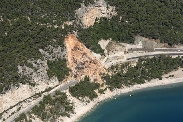
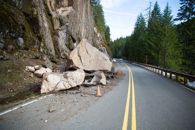
Landslide: A rapid and sudden downward movement of a hill or a mountain mass made up of rocks, sand, and gravel is called a landslide.
Land Reclamation: Improving, recovering, or developing land for human use is known as land reclamation in geography.
Latitude: Imaginary horizontal lines on the Earth that run along the equator in both the hemispheres are known as latitudes.
Lava: Molten rock which flows to the Earth during a volcanic eruption is known as lava.
Leaching: Leaching is the act of removing soluble minerals from the soil by percolation of liquids.
Lee: The sheltered side of the slope or a mound is known as lee.
Lessivage: The downward movement of clay contents in the soil, due to the movement of water is called lessivage.
Lithosphere: The upper layer of the mantle of Earth is called lithosphere. It is approximately 100 km thick.
Litter Layer: It refers to the layer of dead organic litter or waste in the process of decomposition.
Littoral: In geography terms, littoral is used to describe the shore. It can also be defined as the region between the limits of low and high tides.
Load: The rock and gravel material transported by river or any agent of erosion.
Loam: The kind of soil which has approximately equal proportions of sand, silt, and clay.
Longitude: These are the imaginary vertical lines running along the eastern and western hemisphere of the Earth, which are used to measure the distance, location, and time.
Longshore Drift: The net movement of gravel, sand, soil, and sediments along the coastline is known as longshore drift. This movement occurs under gravity.
Low Tide: The lowest point of sea water is known as the low tide.
M
Magma: Magma refers to the molten rock below the surface of the earth. It is normally found in the mantle or the crust of the earth. Find out what is magma made of.
Magma Plume: One of the very crucial geography terms, magma plume is the rising magma within the mantle.
Mangrove Swamp: It refers to a kind of wetland forest which has salt adapted trees. It is mainly found in inter tidal zone of tropical coast areas. They, in addition to preventing soil erosion, on the coasts, also provide a rich habitat for a good amount of biodiversity.
Mantle: Between the crust and the core of the earth, there is another layer. This layer is called the mantle. This word is another ‘must have’ in a geography terms list.
Maquis: Maquis, a French word, basically refers to a shrubland biome, especially in the Mediterranean region. It consists of dense evergreen shrubs, like juniper and myrtle. The word is derived from the plural form of Italian word ‘macchia’, which means thicket in English. It is found in areas where forests have been cleared by humans.
Mariculture: It is a branch of aqua culture, which specializes in the breeding and cultivation of marine organisms in salt water.
Marina: It is an artificial mooring area or dock, especially made for mooring of a pleasure craft, and is protected form the sea.
Maritime: Maritime simply means anything related to the sea. This is one of the most important geography terms.
Maritime Climate: Maritime climate is the climate observed in areas near coastal regions, where the climate is affected by the land’s proximity to the sea.
Marram Grass: This a type of grass, which thrives in dry and sandy environment.
Mean Annual Flood: This is an annual mean average of the optimum flood discharges by a specific river.
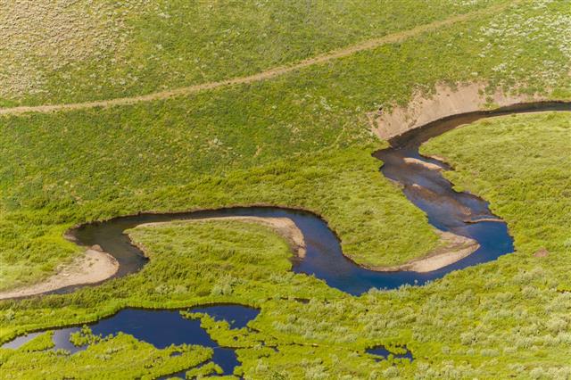
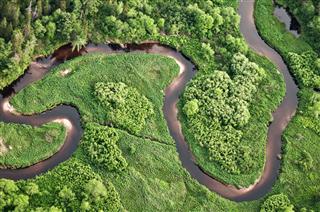
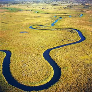
Meander: It is a very pronounced and prominently looping bend in a river. Meanders separate themselves from the river later, and then become non-existent.
Mediterranean Climate: It is the climatic characteristics observed around the Mediterranean region. This is one of the most common geographical terms.
Megalopolis: An expansive length of metropolitan area, brought about by joint urban centers is called a megalopolis.
Meltwater: Meltwater is simply the water which has been derived from the melting of snow or ice.
Meridian: A line passing through the south pole and north pole, forming a circle.
Mesa: A hill having a flat surface at the top, but which rises prominently around the surrounding landscape is called a Mesa.
Mesozoic: It is the name of a geologic era, which existed around 245 to 65 million years ago.
Meteorology: The branch of geography involving the study of atmosphere is called meteorology.
Microclimate: Climatic conditions on a local, micro level, which shows the differentiation between that and the general and macro climatic conditions.
Mid-Oceanic Ridge: Formed by lava, a mid-oceanic rid is a long range of mountains under sea.
Mining: Mining is simply extracting minerals from the crust of the earth for solely industrial objectives.
Mist: It is nothing, but a light fog.
Mistral: Katabatic wind refers to the wind which blows down the slope of a mountain. It is called Mistral in French.
Monoculture: It is a type of an agricultural system, where the norm is to cultivate a single crop.
Monsoon: This refers to a prevailing seasonal wind, which is of two types: summer monsoon and winter monsoon. Well, this is perhaps one of the most cliched and run of the mill geography terms. More on what causes monsoons.
Moor: A hilly tract of land, having typically wet, spongy soil, and comprising moss, heather, and coarse grass is called moor.
Mor: A partially decomposed humus layer having high level of acids and devoid of nutrients is called mor.
Moraine: The movement of a glacier results in transportation of unwanted material from one place to another. So, the debris that is deposited by the glacier is called moraine.
Morphology: It is the study of various landforms and the different processes which result in creation of those particular geographical landforms.
Mouth: The spot where a river joins another water body is called the mouth of the river.
N
National Parks: National parks are areas of land declared as public property by a national government, in order to protect them from human exploitation, and to develop them for recreational purposes.
Natural Decrease: A decrease in human population, due to a high death rate as compared to the birth rate, is known as natural decrease.
Natural Increase: An increase in human population, due to a high birth rate and a low mortality rate, is known is natural increase.
Natural Resources: Natural resources are substances that occur naturally in the nature, and have an economic and commercial value.
Nature Reserve: A nature reserve is an area that has been created for the preservation of a natural heritage, and for the conservation of nature and its components like flora, fauna, geological features, and wildlife.
Neap Tide: A neap tide is a tide that occurs in the first and third quarters of the moon, caused when the difference between the high tide and the low tide is the least.
Nitrate: In geographical terms, nitrate is an inorganic compound made up of one atom of nitrogen and three atoms of oxygen.
Nitrogen Cycle: A cycle related to the circulation of nitrogen in the atmosphere, consisting of certain chemical reactions in which atmospheric nitrogen is converted into nitrogen oxides by lightning, rain, and deposition in soil is called the nitrogen cycle. It is collected and metabolized by the bacteria present in the plants, and is returned to the atmosphere, when organic matter is decomposed by bacteria.
Nitrogen Fixation: Nitrogen fixation is a stage in the nitrogen cycle in which atmospheric nitrogen is converted into ammonia by various bacteria, either naturally or through industrial processes.
Nivation: In geography, soil or rock erosion caused due to the action of frost beneath a snow patch or snowbank is known as nivation.
Nivation Hollow: Nivation hollow is a shallow depression found in periglacial areas, formed by the process of nivation.
Non-renewable Resources: Natural resources that cannot be produced or regenerated, or that are formed at a very slow rate as compared to its consumption, are known as non-renewable resources.
Non-tariff Barrier: Non-tariff barriers are all trade barriers that restrict international trade, but in a form other than tariffs.
North Atlantic Drift: The north Atlantic drift is a warm ocean current, also known as the Gulf Stream, that flows towards, and warms the climate in northwest Europe.
Northing: The difference in latitude, or the distance covered towards the north, from a point of reckoning is called northing.
Nuclear Energy: Nuclear energy is the energy released through either of the nuclear reactions of nuclear fusion or fission.
Nuée Ardente: Nuée ardente is a thick cloud of gas that moves rapidly and is often incandescent. It is formed due to a volcanic eruption, and comprises hot ashes, and other volcanic material.
Nunatak: An isolated mountain or hill which projects through glacial ice and is surrounded by ice sheets is called nunatak.
Nutrient Sink: Nutrient sink is a kind of ecosystem that stocks organic matter and nutrients.
Nutrient Cycle: The circulation of nutrients in the pathways of an ecosystem that includes their use, transformation, release, and storage by plants is known as the nutrient cycle, in geographical terms.
O
Oasis: A fertile area in a desert or on an arid land, formed due to water being present in that particular area, is known as an Oasis.
Obsequent Stream: A stream that flows in a direction opposite to the original slope of the land in the area is called an obsequent stream.
Occlusion: As per geographical definitions, occlusion is an atmospheric phenomenon in which a mass of cold air surrounds a mass of warm air, and forces it to move upwards. If the air surrounding the mass of warm is cooler than the cold air ahead of the warm air, it is called a cold occlusion, whereas, if the air surrounding the mass of warm air is warmer than the cold air, ahead of the warm air, it is called a warm occlusion.
Ocean Basin: The part of the earth’s lithosphere, that is taken up by the oceans comprising the ocean crust is known as the ocean basin.
Ocean Current: An ocean current is the flow of surface ocean water in a definable direction.
Oceanic Crust: The earth’s crust that is found on the ocean floor in the form of a thick mass of igneous rocks is called the oceanic crust.
Oceanic Plate: A part of the earth’s crust that is found below sea-level and consists mainly of sima is known as the oceanic plate.
Ocean Trench: An ocean trench is a deep, long, and narrow depression on the ocean floor, formed due to the sliding of an ocean plate beneath another.
Offshore: Offshore can be defined as the moving away of wind from the shore or land towards the sea.
Omnivore: Omnivore, in geographical terminology, refers to people or animals who feed on both, plants as well as meat.
Onshore: In geographical terms, onshore can be defined as the moving of wind away from the sea towards the shore or land.
Oolith: Ooliths are tiny grains that are spherical in shape, obtained from sedimentary rocks from sea waters, composed of concentric layers of calcium carbonate.
Oolitic Limestone: An oolitic limestone is a type of even textured limestone that comprises ooliths and skeletons of calcareous animals.
Opencast Mining: Opencast mining is the extraction or mining of ores and minerals found close to the surface of the earth, by removing the material lying above and breaking the ore.
Organic Farming: It is defined as an agricultural process of producing foods naturally without the use of synthetic pesticides and fertilizers. Instead, compost, green manure, and environmental friendly methods like crop rotation and mechanical cultivation are used for organic food production.
Orogenesis: Orogenesis is defined as the process through which mountains are formed by the folding and faulting of the earth’s crust. Learn more on how are mountains formed.
Orographic: In geography, orographic refers to anything that is related to mountains or to the study of mountains.
Outwash Plain: In geographical glossary, outwash plain is defined as a flat, sloping surface that comprises gravel and rock debris, deposited by a network of glacial streams.
Overgrazing: The overfeeding of animals on vegetation cover that leads to the damage of the land, is known as overgrazing.
Overland Flow: Overland flow occurs when the water flowing on the land surface flows into a body of water due to over saturation of the land, that it flows on, or due to rainfall exceeding infiltration.
Ox-bow Lake: An Ox-bow lake is a crescent-shaped lake, that is formed when one of its meanders are cut-off or isolated.
Ozone Layer: A region of the earth’s stratosphere that contains a high concentration of ozone, which is responsible for absorbing the harmful ultraviolet radiation of the sun, is called the ozone layer. Read more on ozone layer depletion.
P
Pacific Rim: The far eastern countries located at the margin of the Pacific ocean which includes Australia, China, Hong Kong, Indonesia, Japan, Malaysia, New Zealand, Philippines, South Korea, Singapore, and Taiwan form the Pacific rim.
Pacific Ring of Fire: The Pacific ring of fire is a zone of volcanic and seismic activity located on the Pacific Rim, and falls roughly on the borders of the Pacific Ocean.
Paleoclimate: The inference of the climate of a prehistoric time, obtained by studying geological evidence, is called paleoclimate.
Paleozoic: In geographical usage, paleozoic refers to anything that belongs to the Paleozoic era – an era of geological times that existed about 245 million years ago.
Pastoral Farming: Pastoral farming is a kind of farming that involves the rearing of livestock for obtaining milk, meat, wool, etc.
Percolation: The passage of a liquid substance, like water, through a porous object, like rocks or soil, is known as percolation.
Pesticide: Pesticides are chemical substances, or a mixture of various chemical substances, used to kill pests and to prevent their infestation.
Photochemical Smog: A type of smog or air pollution caused due to photochemical reactions of compounds like nitrogen oxides and hydrocarbons is known as photochemical smog. It is mainly observed in large cities with high levels of air pollution.
Physical Weathering: Physical weathering, also known as mechanical weathering, is the breaking down of rocks and minerals by natural agents like wind, tree roots, action of moving water, and human activities like construction and farming.
Piedmont Glacier: A piedmont glacier is a glacier formed due to the confluence of large valley glaciers to form a stagnant ice sheet. This type of glacier is found mainly in Alaska.
Plantation: A plantation is a large area brought under cultivation, in which the crops are raised by resident workers. These crops are sold in distant regions and are not really made available for local consumption.
Plateau: A large area of land which is slightly raised and has a level surface is called a plateau.
Plate Tectonics: Plate tectonics is a geological theory that explains volcanic and seismic activity, continental drift, formation movement, destruction of the lithospheric plates, and the formation of mountains.
Pollarding: Pollarding is a system of pruning trees regularly in which the main stem of a fast-growing tree is cut, about 2 meters above ground level, to allow healthy development of the branches. The system also involves cutting back of the tree branches to the trunk, to enable it to produce new shoots in abundance.
Potential Evapotranspiration: In geographical terms, potential evapotranspiration is the measure of the amount of moisture that could be lost from the surface of the earth, due to processes such as evaporation and transpiration.
Pressure Gradient: Pressure gradient can be defined as the rate of change of barometric pressure at a particular time in a particular region.
Pressure Melting Point: As per geography terms, pressure melting point is the temperature at which ice melts when pressure is applied to it. This temperature is often below 0°C.
Primary Consumers: Primary consumers, also known as herbivores, are the organisms of the food chain that feed on the primary producers ( green plants).
Prime Meridian: The prime meridian is the line of longitude, designated as 0° and used as a reference line to measure, longitude west and east.
P-wave: P-waves, also known as seismic waves, are elastic waves that are capable of traveling through gases, liquids, and solids. These waves are released when an earthquake occurs.
Q
Quarry: A quarry is a type of open-air, pit mine from which rocks and minerals can be extracted by blasting, digging, or cutting.
Quartz: Quartz is a hard mineral which consists mainly of silica, and can be obtained from different types of rocks. It is the second most abundant mineral found in the earth’s crust.
Quaternary Sector: The part of an economy that focuses on information-based activities is known as the quaternary sector.
R
Rain: In geographical terminology, rain is defined as the water that falls in the form of drops. This water is formed due to the condensation of vapor in the atmosphere.
Rain Gauge: A rain gauge is an instrument that is used to measure the amount of liquid precipitation or rainfall.
Rainshadow: An area having very little precipitation, due to the blockage of winds by barriers like mountains or hills is known as a rainshadow. The very little precipitation in these areas is due to the winds losing their moisture, before they can reach this area.
Raised Beach: A raised beach is a former or ancient beach that is raised slightly above the current shoreline, due to a relative fall in the level of water.
Ranching: Ranching is the running of an extensive farm, known as a ranch, where cattle or sheep are raised. This activity is carried out in areas that are not suitable for any other type of farming.
Ravine: A ravine is a gorge or a deep narrow valley, created by running water.
Reforestation: The process of reviving a forest, that was destroyed by planting new trees or by natural regeneration is known as reforestation.
Recreational Forest: Recreational forests are forests that are specially maintained for activities like bird-watching, camping, horse-riding, etc.
Recycling: The process of extracting useful materials from garbage, that can be put to use after reprocessing is known as recycling.
Red Tide: Red tide, commonly known as ‘algal blooms’, is a phenomenon that occurs due to excessive accumulation of algae, known as dinoflagellates, that causes discoloration of the water.
Regelation: Regelation is the freezing together of two melted ice blocks, when pressure applies is lessened and the melting point of ice rises.
Relative Humidity: In geographical terms, relative humidity is defined as the amount of water vapor in the air at a particular temperature, compared to the maximum amount of water vapor that the air can hold at that temperature. It is expressed in a percentage form.
Renewable Resources: Any natural resource that is naturally restorative at a rate that is more than the rate of human consumption of that resource is called a renewable resource.
Resurgence: It is defined as the return of a river (that was running underground), back to the surface.
Ribbon Lake: Ribbon lakes are long, narrow lakes formed by a glacier, usually found in glacial troughs.
Richter Scale: An instrument or logarithmic scale used to measure the magnitude of an earthquake and the energy released by an earthquake is called a Richter scale. Each increasing step indicates a 10-fold energy increase.
Rift Valley: A long valley formed along a rift in the earth’s crust due to the gradual sinking of land between two parallel series of faults is called a rift valley.
Roche Moutonée: A Roche moutonée is a rock hill that is shaped smooth on the side of the upstream and grooved by glacial abrasion.
Rossby Waves: Rossby waves are the movements of troughs and ridges in the upper air or the jet stream surrounding the earth. It is named after Carl-Gustaf Rossby, who first came up with the theory of this jet stream.
Run-off: Run-off is a term used for the water (from rain or melting snow), that does not get absorbed into the soil, but flows over the surface of the land.
S
Salinization: Salinization is the process by which salt gets increasingly accumulated in soil, which decreases the fertility of the soil.
Salt Lake: A salt lake is a type of inland lake that has a higher concentration of salts (mainly sodium chloride), as compared to other lakes.
Sandbar: A sandbar, also known as a shoal or a sand bank, is a ridge of sand, partly exposed or submerged, formed along a shore or river. This ridge is built by the action of tides, currents, or waves and consists of tiny pebbles, sand, and silt.
Sand Dune: A sand dune is a hill or a mound of sand that is formed by the action of winds along shores or in desert areas.
Savanna: Savanna is a term used to describe tropical grassland areas having scattered vegetation, comprising densely spaced trees and bushes. The term was originally used to describe tropical grasslands with some scattered dense tree areas.
Sea Breeze: A sea breeze is a cooling local wind that blows from the sea to the land, due to differences in temperature of the surface of the land and the surface of the sea.
Sea-level Change: Sea-level change is a change in the volume of water in the seas and oceans, with respect to a change in the position of the land. Sea-level change is of two types – eustatic, where there is change in the level of water due to the melting of ice and snow, and isostatic, where there is a change in the vertical position of the land caused by the melting of ice and snow in large quantities.
Sea-wave: In geographical terms, waves that indicate a horizontal energy movement, but a vertical movement of water are known as sea-waves.
Secondary Consumer: Secondary consumers, also known as carnivores, are organisms of the food chain that mainly feed on primary consumers, and secondary consumers at times.
Sedimentary Rock: Sedimentary rocks are rocks which are formed by the deposition and solidification of sediments and organic matter from pre-existing rocks in layers. These sediments may be deposited by running water, wind, or ice.
Seed Dispersal: Seed dispersal is a process in which the plant seeds move away from the parent seed through the action of winds, water, insects, etc. The process transports seeds to suitable habitats from their source, for their successful germination.
Seismic: Seismic is a term used to define anything that is related to or caused by the vibration of earth or an earthquake.
Shield Volcano: A shield volcano is a rounded, wide volcano having gentle sloes formed due to the solidification of layers of fluid basaltic lava.
Sial: Sial is a type of rock that is rich in silica and aluminum, found in the upper layer of the earth’s crust.
Silt: Sedimentary material comprising tiny particles of rock, larger than clay and smaller than sand.
Sima: The layer of the earth’s outer crust that is rich in silica and magnesium, and that lies below the sial.
Soil Conservation: Soil conservation is a soil management technique used to prevent soil erosion and soil deterioration.
Soil Profile: A vertical section of the soil indicating the different layers of soil, from the surface to the parent rock is called soil profile.
Soil Science: It is a scientific field that pertains to the study of soil as a natural resource. This includes the study of soil properties, soil formation, and soil classification.
Soil Structure: Soil structure is the manner in which the soil particles like sand, humus, silt, and clay are arranged to form large units known as peds. Prism-like, block-like, spheroidal, and platey are the four major structural forms of soil.
Solar Radiation: The electromagnetic radiation emitted by the sun, resulting from a nuclear fusion reaction, is known as solar radiation.
Spheroidal Weathering: Spheroidal weathering is a process through which chemical weathering wears out the edges and sides of a rock, due to which the rock appears round in shape.
Spring Tide: Spring tide is the term used to describe extremely high and low tides, occurring during a full moon or a new moon, when the sun, moon, and the earth are more or less aligned.
Stemflow: Stemflow is a process by which intercepted precipitation is directed to flow down the branches and stems of plants, so that, the ground below them receives some more moisture.
Stilling Well: A stilling well is a cube or a cylindrical compartment, that is installed near a river or sunk in the river. It dampens surges and waves to provide an accurate measurement of the water level of the river.
Storm Beach: A storm beach is a steep beach that comprises sand and stones, deposited by strong storms and waves, that rise above the high watermark.
Storm Surge: An unusual rise in the normal water level on an open coast caused by high waves and winds associated with hurricanes and low atmospheric pressure is called a storm surge.
Strata: In geographical terms, strata can be defined as, the bed of rock of a particular kind (usually sedimentary), comprising many uniform layers, which are formed naturally by materials that get deposited over time.
Stratosphere: Stratosphere is the part of the earth’s atmosphere that lies below the mesosphere and above the troposphere. It extends from 10km to 50km above the surface of the earth.
Strip Farming: Strip farming is a technique of farming, where field crops are grown in alternate, narrow strips, following the contour of the land. This technique is used to reduce or prevent soil erosion.
Subduction: Subduction is a geological process in which an edge of a crustal plate is forced below the edge of another plate, that sinks into the mantle on the convergence of plates.
Sublimation: Sublimation is a term used to describe the changing of a solid into the gaseous state without going through the liquid phase.
Superimposed Drainage: Superimposed drainage is a drainage system that naturally evolved on a set of rocks, which were subsequently immersed by river incision. Therefore, the drainage system is unrelated to the rocks, that it now lies on.
Sustainable Agriculture: Sustainable agriculture is a method of farming that implements eco-friendly techniques of farming, to ensure that the natural resources are not degraded. Sustainable agriculture also supports increased production of crops.
Swamp: A type of lowland that is seasonally flooded or waterlogged with stagnant water and has woody vegetation cover is known as a swamp.
Swash: Swash, in geography, is a term used to describe water from the break of a wave, moving up the shore or beach.
S-wave: An S-wave is defined as a type of seismic wave, that carries rock particles in a direction, that is perpendicular to the direction in which the wave itself is traveling. The S-wave is also known as the secondary wave or the shear wave.
Synoptic Chart: The synoptic chart is a type of weather map that indicates the atmospheric state of a large area at any given time.
T
Talik: Talik is a Russian term used to describe a permanently unfrozen section of ground in a region of permafrost. There are different types of talik like: through talik, closed talik, and open talik.
Tectonic: Tectonic is a term used to define anything that is causing, related to, or resulting from processes that work to give the earth’s crust some sort of shape.
Temperate Deciduous Forest: Temperate deciduous forests are seasonal biomes found in central, western and eastern Europe, eastern Australia, some parts of China and Japan, and eastern North America. These forests are characterized by moderate temperature, rainfall, and deciduous trees like oak, maple, ash, etc. which shed their leaves annually.
Temperature Inversion: Temperature inversion is a phenomenon in which the temperature increases with increasing altitude, instead of decreasing with increasing altitude. This is due to factors like sea air being invaded by onshore breeze that is cooler than the sea air, or because of the passage of a cold front.
Thermosphere: Thermosphere is the outermost surface of the atmosphere, that lies above the mesosphere, and below the exosphere. It is a region where temperature increases steadily with altitude.
Tidal Energy: The energy obtained from harnessing tidal motions of water is called tidal energy. The energy harnessed is used to produce electricity.
Topographical Map: Topographical map is a type of large-scale map that represents both natural and man-made two-dimensional, surface geographical features.
Tornado: A tornado is a violent and destructive windstorm or column of air that extends downwards from a cumulonimbus or funnel-shaped cloud. Its speed is about 100 to 300 miles per hour, and it is known to cause a lot of destruction along its path.
Toxic Waste: Poisonous waste material that comprises chemical compounds, which can cause injury or death if inhaled or ingested, is called toxic waste.
Trade Winds: Trade winds are the steady winds that blow towards the equator, from the northeast in the northern hemisphere, and from the southeast in the southern hemisphere.
Transpiration: The process by which moisture leaves the plants and gets released into the atmosphere, through small openings in the leaves, known as stomata is transpiration. This process is regulated by the plant on the basis of its water requirement, climate, and the process also affects the growth and wilting of the plant.
Tributary: A tributary is a stream or river that flows into a larger river or a body of water, called the main channel.
Tropical Cyclone: A tropical cyclone is a type of violent storm that develops over tropical and subtropical water bodies, between latitudes 23°30′ North and 23°30′ South. It is characterized by heavy, violent rainstorms, and cyclonic winds and is known by different names like willy-willy, taifu, etc. in different countries.
Trophic Level: Trophic level is the position in the food chain that is occupied by different organisms. The trophic level indicates the frequency of energy transfer that has taken place through feeding.
Tropical Rainforest: Tropical rainforest is a biome situated in regions of high rainfall and high temperature. It consists of tall evergreen trees that grow close to each other, and are known to have the maximum number of medicinal plants. The trees have columnar trunks that are somewhat unbranched and they form a flat crown that spreads frequently. Read more on tropical rainforest biome.
Troposphere: Troposphere is the atmospheric zone that is the lowest. It is situated between the tropopause and the earth’s crust, and comprises vertical wind motions and water vapor. It is characterized by a decrease in temperature with increasing altitude.
Tsunami: A tsunami is a huge ocean wave that occurs due to an underwater volcanic eruption or earthquake. It can travel at speeds of 600 km/hr, and can soar up to heights of 30 m.
Tundra: The vast, treeless region located in the Arctic and subarctic regions, and characterized by black mucky soil and frozen subsoils is known as the tundra region. This region extends across Europe, North America, and Greenland.
Twilight Zone: The twilight zone is the lowest level or the point up to which natural light can penetrate in the ocean.
Typhoon: Typhoon refers to a type of tropical cyclone that occurs typically in the Indian ocean and the western Pacific ocean.
U
Ubac: The northern side of an Alpine mountain that is shady and characterized by a low snow line and timberline is known as Ubac.
Urban Climate: The climatic condition of a large metropolitan area, that is considerably different from the climate in the rural areas surrounding it, is called urban climate.
U-shaped Valley: A U-shaped valley is a type of glacial valley formed due to glacial erosion, and characterized by steep walls and broad floors.
Utility: In geographical terminology, utility is a term used to describe an industry that provides a service or commodity that can be used by consumers.
V
Valley Glacier: A valley glacier is a glacier, that is enclosed by the walls of a mountain valley, and flows down these walls.
Varve: A varve is a sediment bed, made up of a series of sediment layers, which are annually deposited in a still water body near a glacial area.
Vector: In geographical terms, vector is defined as a force that has both direction and magnitude.
Vent: A vent is a pipe like opening in the earth’s crust, that directs the flow of volcanic material. A volcano may have one or more than one vent.
Visibility: Visibility is defined as the maximum distance up to which a person can see under a particular weather condition, without the assistance of any instrument.
Volcanic Cone: A volcanic cone is a conical hill formed during a volcanic eruption made up of lava, tufa, and cinders.
Volcanic Plume: Volcanic plume is a mixture of gas, lava, and other particles, that are emitted during a volcanic eruption, generated when the magma is fragmented.
Volcano: A volcano is a landform, often a mountain, through which magma, gases, and ashes erupt and flow out.
V-shaped Valley: A v-shaped valley is a valley that has a cross-sectional profile, and that is formed by the eroding action of streams.
Vulcanism: Vulcanism, also known as volcanism, is a term used to describe the study of any kind of volcanic activity.
W
Wadi: A wadi is the Arabic term for a valley or stream bed in northern Africa and the Middle East. It remains dry throughout the year, except during the rainy season.
Warm front: Warm front is referred to the front of a mass of warm air.
Walker Cell: The Walker circulation is also known as the Walker cell. It is a conceptual model of the air flow in the tropics in the troposphere. Parcels of air follow a closed circulation in zonal and vertical directions, according to this theory.
Water balance: Water balance refers to the ratio between the water assimilated in the body and water lost from the body.
Waterlogged: Waterlogged is a phenomenon where an object is heavily filled or flooded with water, that, it seems to be heavy or unmanageable.
Water Management: Water management is the activity that consists of planning, development, distribution, and optimum use of water resources, under defined water policies and regulations.
Watershed: Watershed refers to the ridge or crest line dividing two drainage areas.
Water Table: In geography, the term water table means a planar underground surface beneath which, earth materials such as soil or rock are saturated with water. At this level, the ground water pressure is equal to the atmospheric pressure.
Wave: The term wave can be explained as a disturbance on the surface of a liquid body, such as a sea or a lake. This disturbance is ordinarily in the form of a moving ridge or swell.
Wave-cut Notch: A wave-cut notch or platform or shore platform is the narrow flat area that is often seen at the base of a sea cliff. It can also be seen along a large lake shore caused by the action of waves.
Wave-Cut Platform: A wave-cut platform is the same as a wave cut notch.
Wave Pounding: Wave pounding is the ‘sledge hammer’ effect that is caused by tons of water crashing against cliffs. It is responsible for shaking and weakening the rocks, leaving them open to attack from hydraulic action and abrasion. Eroded material, mostly, gets carried away by the waves.
Weather: In simple words, weather refers to the state of the atmosphere with respect to wind, temperature, cloudiness, moisture, pressure, etc.
Weathering: Weathering refers to the various mechanical and chemical processes that cause the exposed rock to decompose.
Well: As opposed to literature, in geography, the term well refers to a hole drilled or bored into the earth to obtain water, petroleum, natural gas, brine, and sulfur.
Wetland: A wetland is a lowland area, such as a marsh or a swamp, that is saturated with moisture. It is mostly regarded as the natural habitat of wildlife.
Wetted Perimeter: A wetted perimeter is the perimeter of the cross-section of the area that is ‘wet’.
Wilderness: Wilderness refers to a wild and uncultivated region, such as a forest or a desert. It is inhabited only by wild animals. It could also mean a tract of wasteland.
Wilting Point: Much like boiling point and evaporation point, wilting point (WP) is defined as the minimal point of soil moisture required by the plant to avoid its wilting. In case, the moisture decreases to this point or any lower, a plant wilts, and can no longer recover its turgidity when placed in a saturated atmosphere for about 12 hours.
Wind: Wind, in geography, refers to the air moving from an area of high pressure to an area of low pressure.
Wind Erosion: In geography, wind erosion refers to the erosion of material caused by the action and chemical reaction of wind.
Wind power: Wind power refers to the conversion of wind energy into a useful form of energy, such as electricity, using wind turbines.
Windward: In simple words, the term windward refers to ‘towards the wind’. More so, it directs towards the point from which the wind blows.
X
Xerophytic: In geography, xerophytic refers to one which has adapted itself to a xeric (which means dry) environment.
Xerosere: Xerosere refers to describing a sere occurring in dry soil.
Y
Yardang: In geography, yardang refers to a keel-shaped crest or ridge of rock. It is formed by the action of wind, usually parallel to the prevailing wind direction.
Yield: The term yield has a lot of interpretations in several contexts. However, in geography, the term yield refers to give forth or produce by a natural process or in return for cultivation.
Younger Dryas: In geography, dryas refers to any creeping plant belonging to the genus Dryas, of the rose family, having solitary white or yellow flowers, comprising the mountain avens. Hence a younger dryas refers to a dryas that is younger in age.
Z
Zeugen: Zeugen, also known as mushroom rocks or rock pedestals, are one of the most striking manifestation of the processes of erosion and weathering. They are mostly found in deserts.
Zonal soil: Zonal soil refers to any one of the great groups of soil which have well-developed soil characteristics and reflect the zonal influence of climate and living organisms, mainly vegetation, as active factors of soil genesis.
Zooplankton: In geographic terms, a zooplankton refers to the aggregate of animals or animal-like organisms, as protozoans.
Geography is a subject which plays an important role in our everyday lives. But sometimes, we get tangled in its complex jargon. Remember, it is a subset of science, which deals with every natural phenomena and everything that’s related to them.
